Utah trip - day 5 - May 8, 2022 (Su)
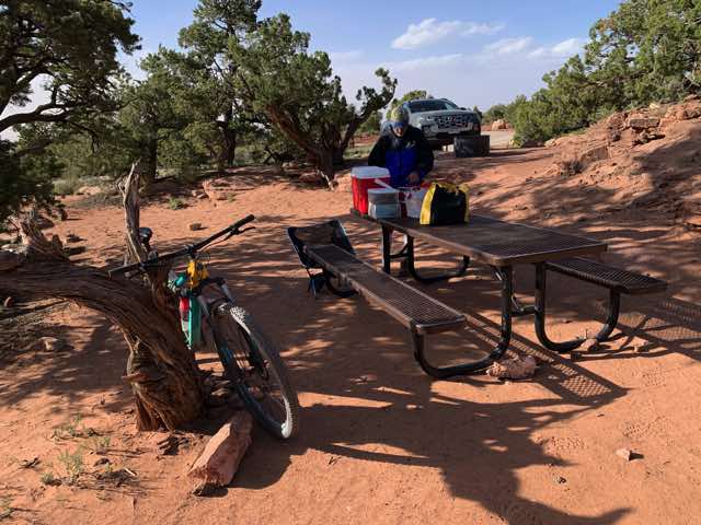
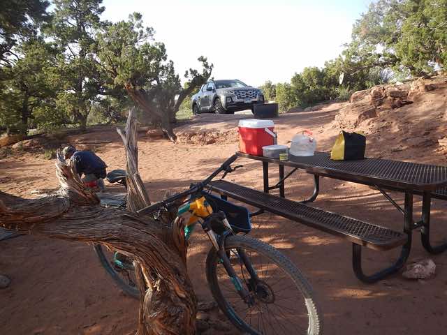
It was a windy night. Even with the fly on, sand still got into my tent. We had some breakfast, locked up our bikes to the picnic table, and then headed to Canyonlands National Park about 7:30 or so. We were able to be at the Visitor Center in the park just as it opened. We talked to one of the rangers about our trip in 2 days and considered the logistics. We filled up some water containers with their water supply. I ended back in to talk to the ranger again and mentioned us hiking the Syncline Loop Trail. (Two more links: first and second.) She was quite adamant about making sure we took plenty of water (pointedly asking me how much water we were planning on taking and then telling me to take more). She had to do a rescue the day before for someone on that trail.
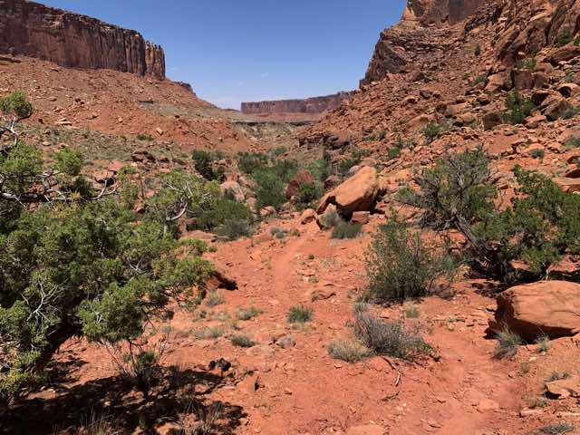
We then drove to the trail head for this hike and began it. The plan was to go clockwise around the loop which meant a climb down to the lower level and then later back up. It was quite windy and we headed down the trail.
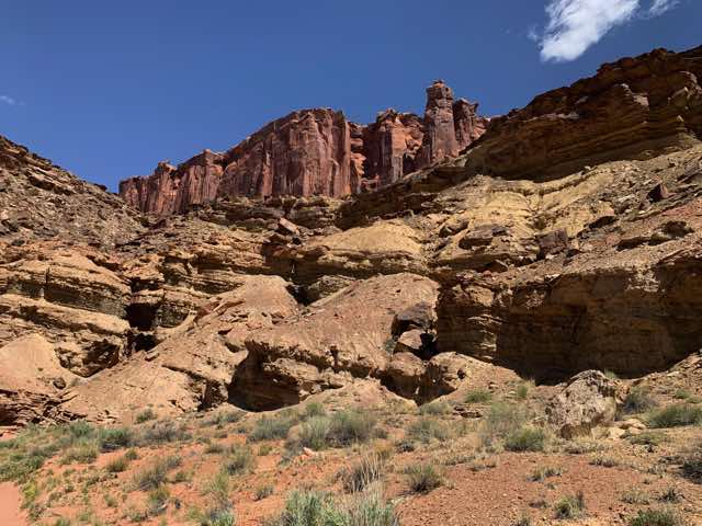
Beginning of the Syncline loop
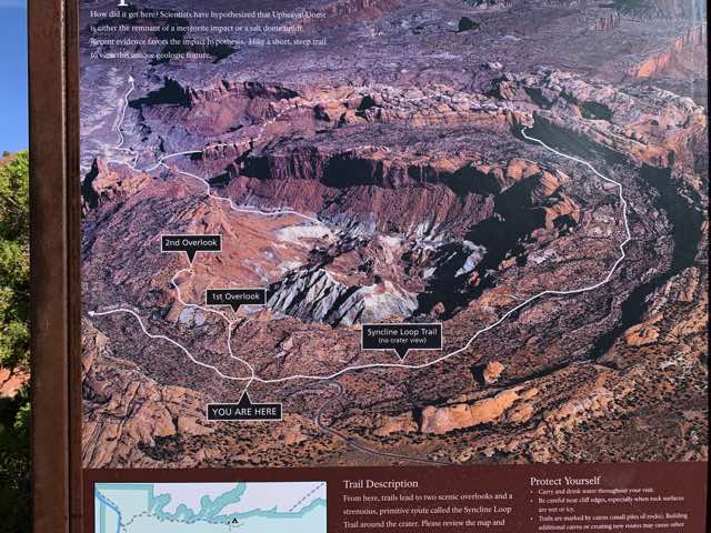
Map of the Syncline loop
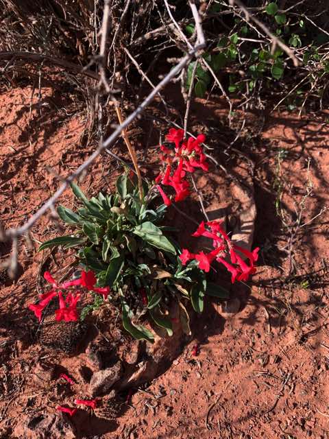
flowers along the trail
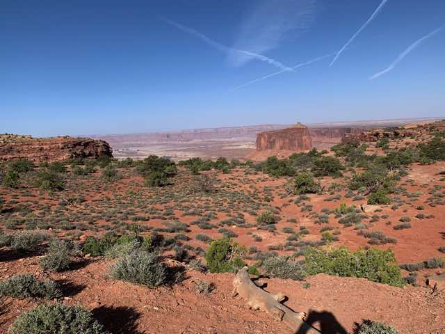
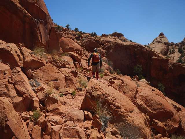
Near the start of Syncline loop
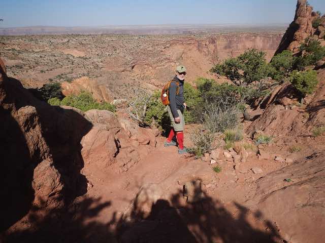
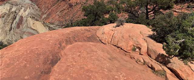
Somewhere near the start of Syncline loop
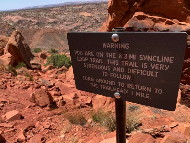
After about 20 minutes, we saw a sign on the trail just before it starts a more serious descent:
WARNING
YOU ARE ON THE 8.3 MI SYNCLINE LOOP TRAIL. THIS TRAIL IS VERY STRENUOUS AND DIFFICULT TO FOLLOW.
TURN AROUND TO RETURN TO THE TRAILHEAD: 1 MILE.
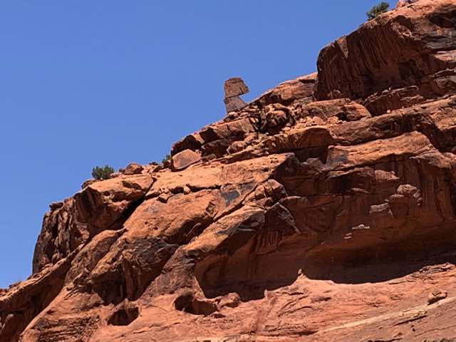
Near the start of Syncline loop
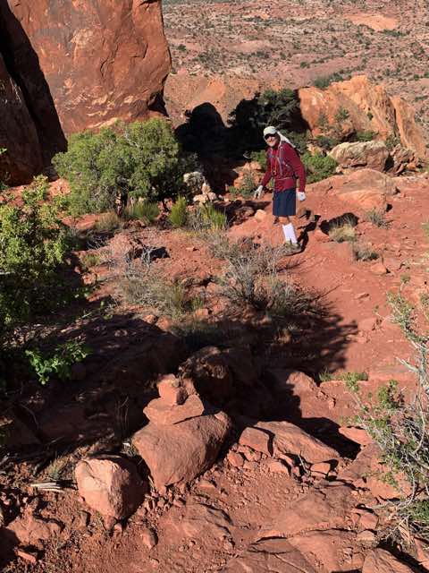
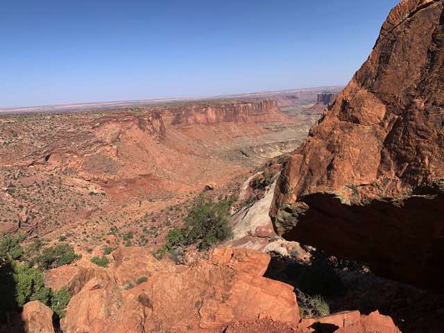
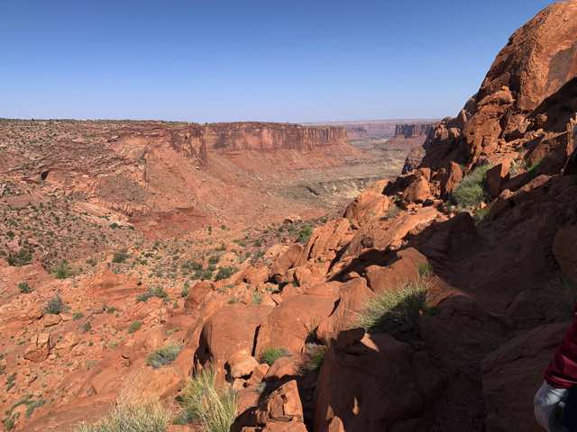
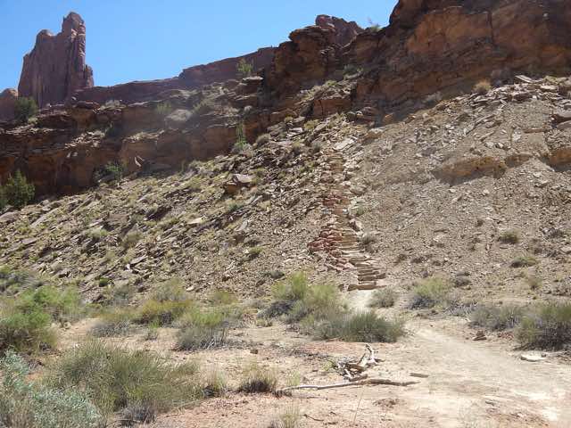
We kept going, knowing all this. We started our descent (1300 foot elevation change) and it soon led us up to a ledge and that is where the real descent began. With switchbacks and stone steps or terraces, the path was usually relatively easy to follow in this part with key cairns helping to mark where there may be doubt. We eventually got to the bottom on a dry wash and we continued working down that. We made decent progress but when we got to where we saw the Crater Spur Trail that led steeply up in one direction and the Upheaval Canyon Trail going diametrically opposite, we had issues. The trail, cairns, and footprints seemed to thin out, which is not a good sign. We tried to back up and redo our course and we reevaluated the posted signs and the map showing our location on the phone. We determined what direction we needed to head and proceeded on. We should have re-evaluated after 5 minutes. Instead, about 50 minutes later I started having an uneasy feeling and sensed that our curvature was not what I expected. I then checked my phone to show our gps coordinates on the map and it showed we were about 15 minutes from where we had previously lowered ourselves into the dry wash. In other words, we had simply backed up and retraced our steps. The trail was fairly wide in the wash and there was not a single trail that we should have recognized from earlier. So instead of going back to where we were and finishing the full loop, we completed the first half of the loop both forwards and backwards. Oh well. We made the ascent where we had previously descended, which was a little more work in this direction. When we got back to the beginning, we rested a bit, drank and ate, and then hiked 0.3 miles to an overlook into the interior of the Upheaval Dome.
We are going to go down there
Making some progress
The ledge where the descent begins in earnest
Down and now looking up
Trail in the dry wash
Up the Crater Spur Trail
We slowly make our ascent back up
Site on the way back up
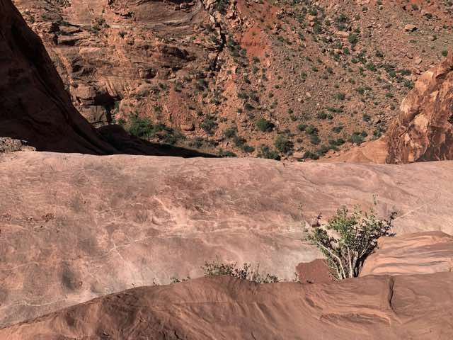
Looking down near the Upheaval Dome
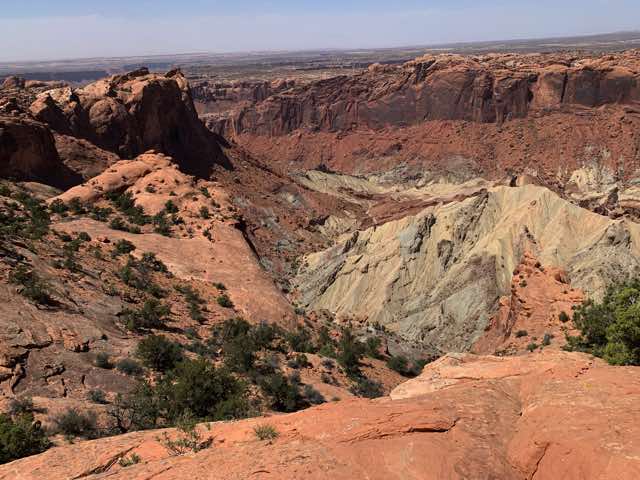
Looking down at the Upheaval Dome
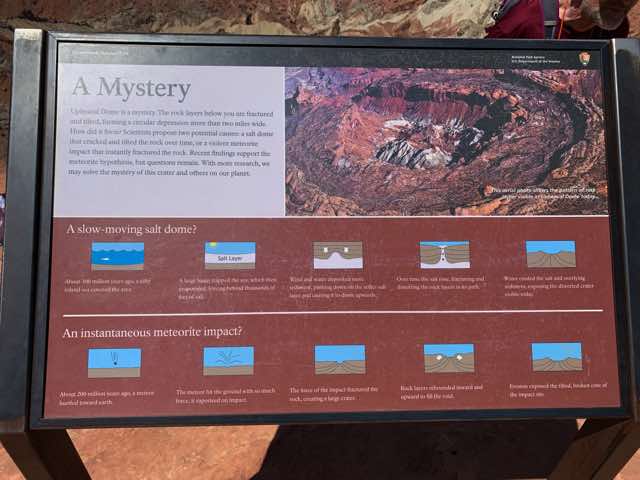
Sign about the Upheaval Dome
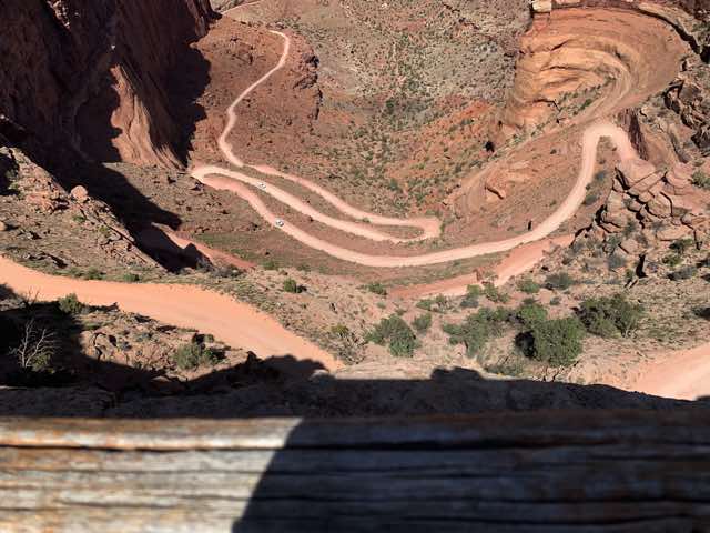
After this, we drove to an observation area where the Shafer trail switchbacks takes one up or down a 1500 feet change in elevation. (More links on Shafer trail: first and second) Our plans were to be driving down this Tuesday morning and either biking up it right then or biking down it on Wednesday (depending if we go counter-clockwise or clockwise, respectively). We watched various vehicles coming up or going down and negotiating with each other when near each other. (One going up receives priority, says the protocol.) That was interesting and a bit intimidating knowing that we will be doing this soon. Actually, after the biking we had done thus far, I felt better about it than I did a month ago.
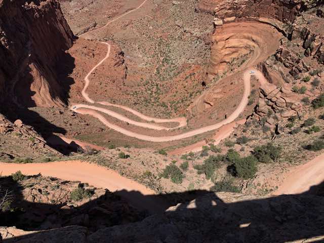
View of Shafer Road from observation area - vehicle on right waiting for upcoming vehicle
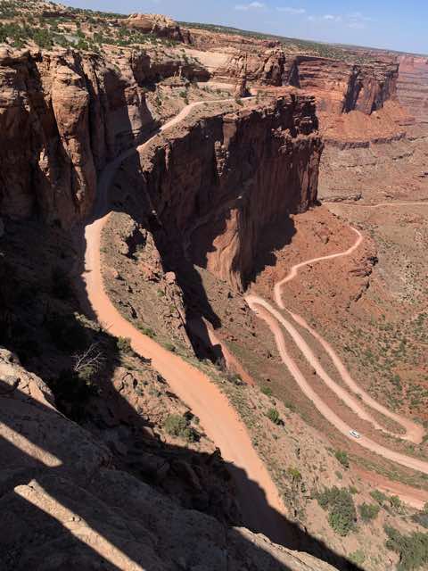
View of Shafer Road looking northwards
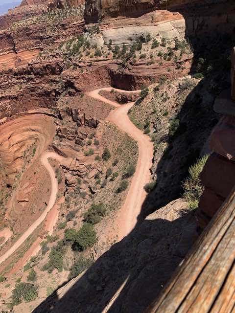
View of Shafer Road looking southwards
Another view of Shafer Road
We then drove back to our campsite at Horsethief Campground, with supper on our minds (at least mine). The first thing I noticed was that my tent was not still set up, but Norm's was. Upon inspection, it was clear that the wind had pulled up the stakes and blown the tent aside. Someone gathered up the stakes and put them in a pile and tried to stuff my tent in an area where it wouldn't blow further. Thank you to whoever; I appreciate it. If I recall, Norm had a small tear in his fly, but otherwise his tent was OK. Since it was still really windy and supposed to only get worse in the next few days, we started looking for another campsite. We found a few candidates and then I biked over to the campground host and asked about the logistics to switching and she was fine with it. All we needed to do was simply move our tag to the new site. We found one with a low bowel for a tent area and set up a new camp. Norm found a place between two junipers to nestle his tent into and I found some shelter under another juniper. We ate supper, read more from the White Rim booklet, discussed the pros and cons about which direction to take, and also did a little bit of biking to loosen the muscles. Then to bed with the strong winds singing us to sleep.
View of our new campsite
I am setting up my tent at our new campsite
Published 2022-05-21