Utah trip - day 6 - May 9, 2022 (M)
It was another windy night, but we made it through OK. We got up and had breakfast and prepared to drive to Dead Horse Point State Park. As we prepared to leave, I asked Norm about leaving the tents set up or not. I was concerned about the wind, but he thought things would be OK. I had rocks on most or all of the stakes and we decided to leave them intact.
We drove from the campground on Mineral Point Rd, turned south on UT 313 toward Canyonlands NP. After a bit, there was a left-hand turn to a road leading to Dead Horse Point SP, which actually is the continuation of UT 313 whereas going straight puts one on Island in the Sky Rd which soon takes one to Canyonlands NP. Driving east for a bit and then south, we landed at the Visitor Center for the state park about 5-7 miles later. We parked and got out our bikes, since the offices were not yet open.
View from Dead Horse Point SP Visitor Center
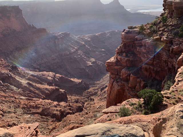
We biked on UT 313 until it dead-ended at Dead Horse Point, a great overlook to the canyons carved by the Colorado River. We spent some time at various pull-offs along the way; it was quite gorgeous. We then biked back and visited the Visitor Center for a bit and then took off on some of the park's established bike trails. These were mostly one-track trails, though sometimes just over sections of bedrock. We left the Visitor Center on the Intrepid trail, which was supposed to be a basic trail despite it having a few rougher sections. There were a number of other bikers, including families, but it was not crowded where we rode. We then took the Great Pyramid trail hoping to find a nice lookout, but we didn't find it. We did find large patches of sand that were not so easy to bike in. (See map.) We then took the Raven Roll trail which went by the park's collection of Yurt structures and then the Crossroads trail that crossed UT 313. At the next intersection, we decided to go up Twisted Tree trail for a bit to get a view. It was a bit hard to follow the trail and eventually the area opened into a broad section consisting of mostly bedrock that was a challenge to navigate and to find the trail. We got off to go look at the overlook into a deep ravine. When we walked back to our bikes, we had trouble trying find the trail again. After a bit, we saw some other bikers and the trail was more evident when we walked over to talk with them. We finished up on Prickly Pair [sic] which also had a few challenges, but quite doable. This took us back to Intrepid and to our truck. We then headed back to our campsite and arrived after 1:00.
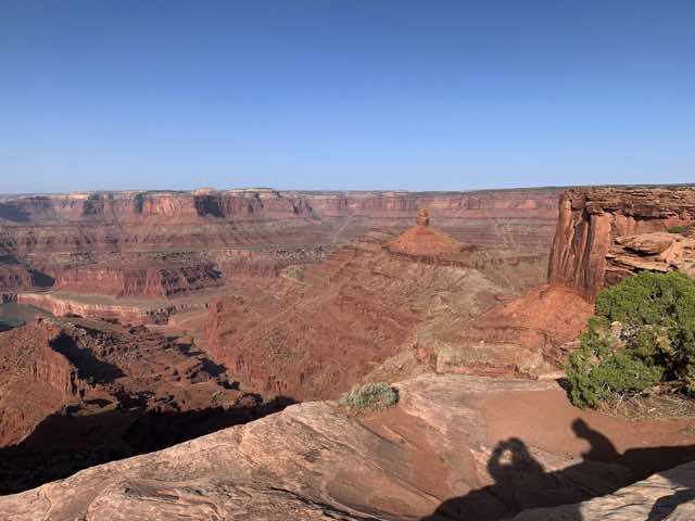
View as headed to Dead Horse Point (looking SW)
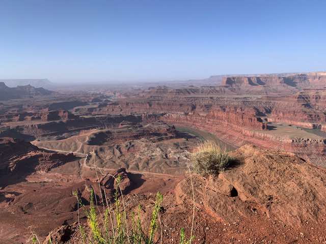
Same location but turning more eastward. Note the Colorado River
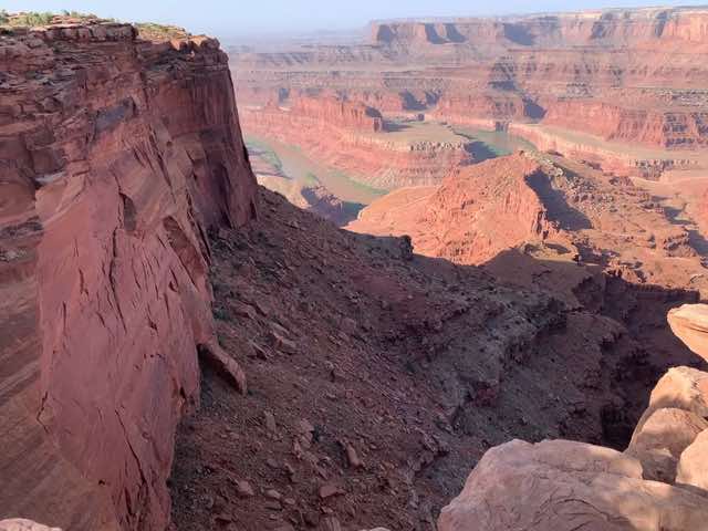
Similar, but closer, view as the last.
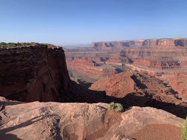
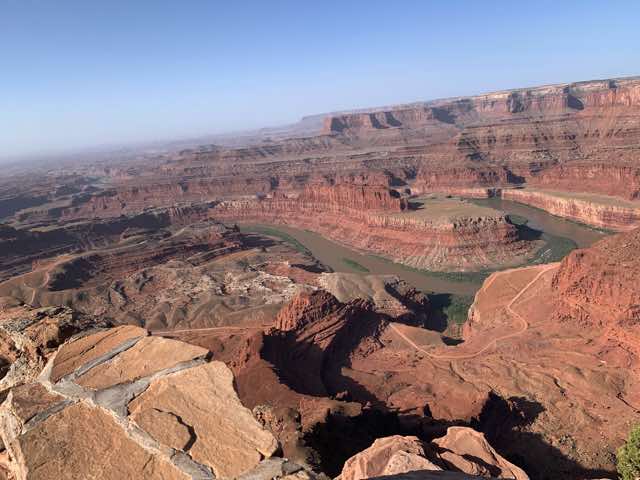
View from the terminal Dead Horse Point, looking SW
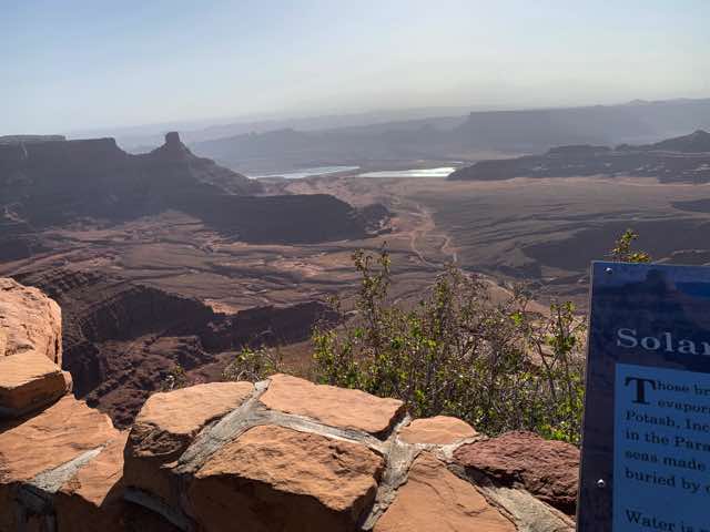
View from the terminal Dead Horse Point, looking SE. Note the large bodies of water. These are evaporation ponds for a potash manufacturing site.
A view from a lookout that we skipped as we first went to the end.
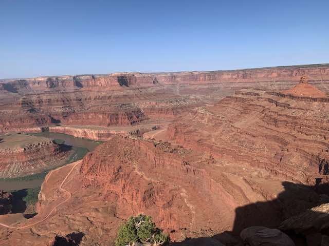
Another view from last photo's location but looking more westward.
While my tent was still there and not blown away, the west winds had pulled it off the west stakes and it was on its side supported by the two east stakes (and cords attached to the tree). This happened despite the tent having my sleeping pad, sleeping bag, and other items within it. Did I mention that it was still windy? We spent the afternoon organizing our items and preparing for the White Rim Road ride the next two days. I had a pack of 8 burritos and I spread peanut butter over each and made rollups from them (eating one then). I did the same for a bag of 5 bagels. I parsed out the Cliff and Lärabar bars and found places to store them. I got all the water bottles and bags filled and ready. I chose the clothes and other things to bring and not bring. There were potentially cooler mornings, so I wanted enough to wear so that I wasn't cold, but not so much that I had to work to find storage space. We also talked about the orientation to take and decided on going clockwise, which meant aiming for 63 miles the first day and about 37 the second day. We also, independently, took some local bike rides around the area. It was still quite windy. We then had supper and continued to review the White Rim booklet from Lou. We had decided to try to wake up at 5:00 a.m. so that we could try to be biking when it is 30 minutes before sunrise. Therefore, we headed to bed while it was still light and did some reading and resting and listening to the winds rattle our tents.
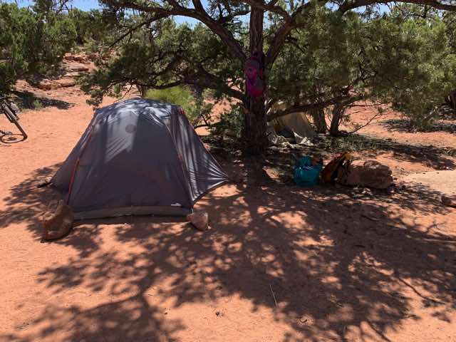
Our tent setup for our third day at Horsethief Campground
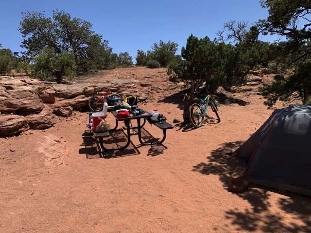
Getting organized for the White Rim ride
Published 2022-05-21