Utah trip - day 7 - May 10, 2022 (T)
It was another windy night. I woke up in the middle of the night and walked to the outhouse so that I could get back to sleep after giving my bladder some relief. I noticed then that my Achilles tendons were hurting a bit. I wondered if Norm would be able to hear me from the tent (due to wind noise) when my 5:00 alarm rang. I got back to sleep, but then I woke up about 4:15, partly because of anticipating waking up soon but also since the wind was blowing harder. About 4:40, Norm yelled to me "What time is it?". He hadn't changed his watch from central to mountain time and perhaps not fully awake yet, he was wondering why it was 5:40 and we were not up yet. Well, we both got up then. We packed up everything and made sure to know what we wanted for our ride and what stayed in the truck. We left the campground when it was still dark, but hints of light were coming from the east. We drove to the beginning of the Shafer trail (but marked as S Fork Rd on my Apple Maps app), which is also called road 142, Shafer Canyon Road and Shafer Basin Road on Google Maps.
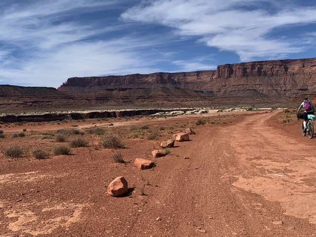
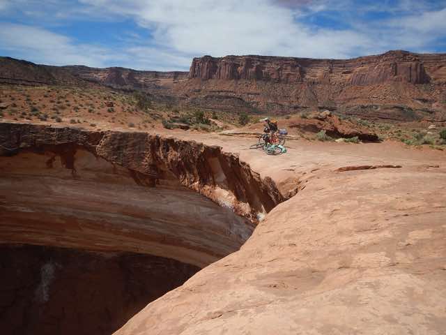
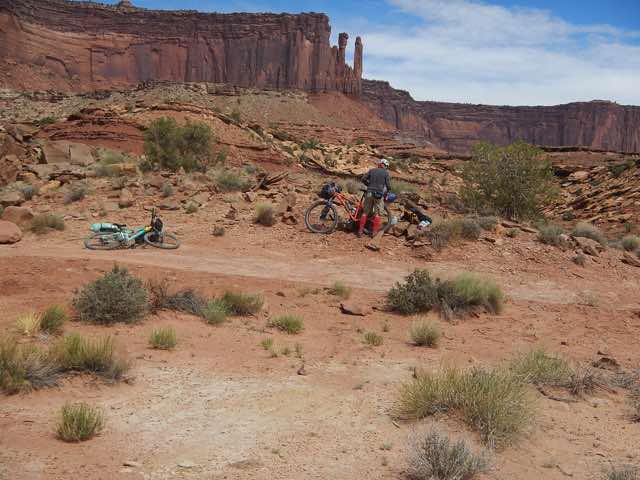
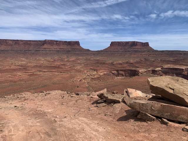
Our White Rim trip was just now beginning. It was getting light enough to see better. Norm and I both forgot how long of a drive it was to the beginning of the switchbacks. The road was posted at 15 mph and we hoped to not see anybody coming up, but we also didn't expect anyone at this time. At the second hairpin turn, Norm couldn't see around the corner at all, both because of the angle and the darkness. I recommended backing up a bit and then turning and that worked well to get us around that corner. It was so much easier to navigate these corners the next day in bright light and on a bike. Being in a vehicle, it is hard to see over the hood and through the metal supports of the roof. After two more hairpin corners, we had a straight shot to the bottom. We saw the turnoff to Moab via the Potash Road and the nearby outhouse, but there was no clear parking spot available other than a narrow stretch in front of the outhouse. We parked there and searched if there was a better spot and decided this was the best, so we posted our parking permit and sun visor to the window. We then got our bikes out and worked on mounting our equipment. Norm had a bag that he mounted on a rack that was attached to his seat post and then another bag that he mounted in front of his handlebars and then he wore his backpack. I also had a rear rack that was supported by the bike frame and I mounted a bag to it with Voile straps. My tent was designed to mount to the front of the handlebars, so I added that. Then I also added a smaller front bag in front of the tent that I had used on my trip around Lake Superior in 1977, but I had to jerry-rig this to my handlebars. But by this day, I had figured out how to securely attach it. I also had a backpack. We were then ready to head out and we did so at about 6:30, a bit later than our goal.
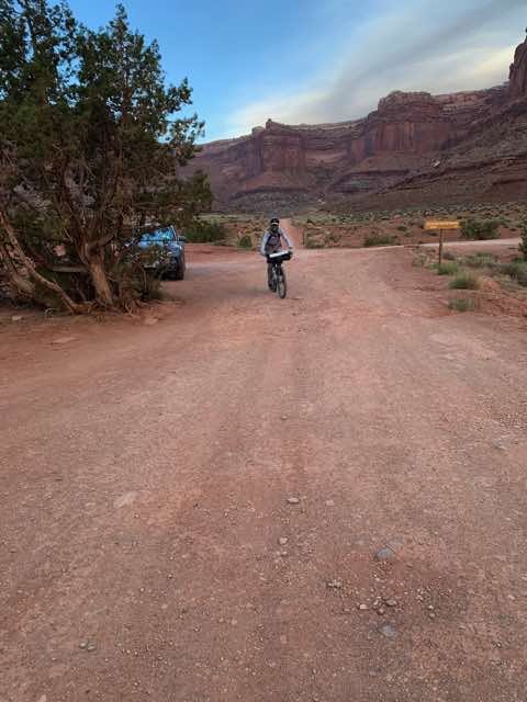
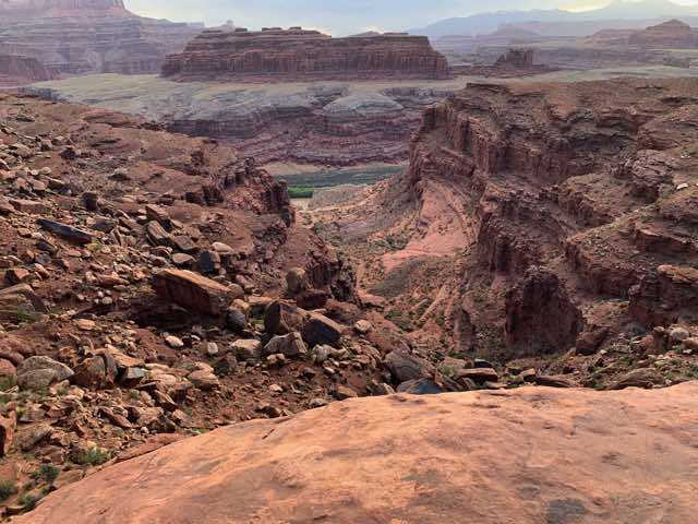
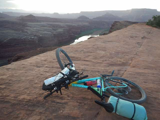
6:29:10 AM departure with background from whence we had come
We headed eastward and then soon turned to the SE and climbed a long, gradual hill. The winds were coming out of the SE and were supposed to switch to coming from the SW (meaning that they would be out of the south all day). After a bit we could more clearly see the Colorado River. This was after a long, rocky downhill. Norm had stopped near the top to reconfigure his front pack and I had went on ahead for a bit. When he arrived, I noticed that his water bottle attached to his fork was missing. He didn't know notice it had fallen, but I knew it couldn't be more than a mile back since that was where he last had stopped. I biked back to find it and on the way, I found my stocking cap that I had taken off earlier and hastily put into my rear bag. I put it back in and added an extra fold before sealing the bag. I then continued up the hill and I found his bottle in the middle of the road shortly below where he had stopped. Not having a place to put it, I placed it in the "V" between my tent and the handlebars, trying to hold it with one hand while riding. I dropped it once on my way to Norm, but then passed it off to him. We continued on our way. As we found short walks or bike rides to lookovers, we did them.
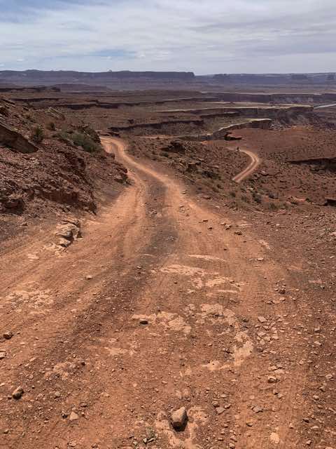
General direction into which we are biking (6:50)
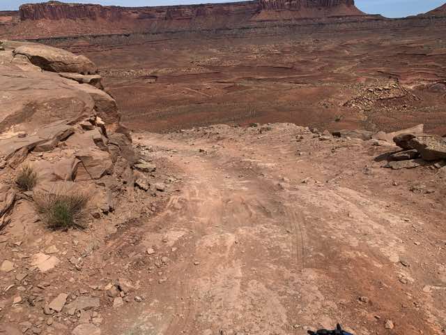
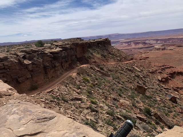
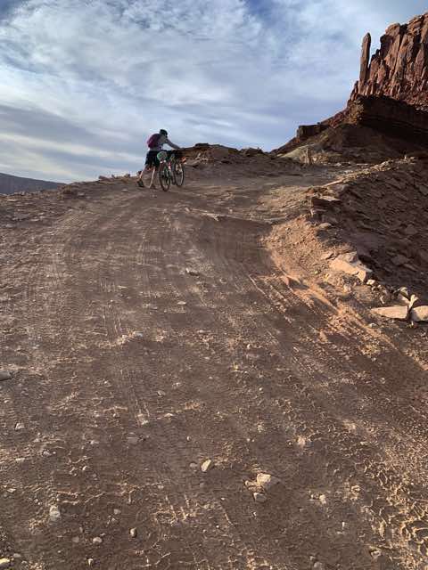
The road we will be taking is visible on the right
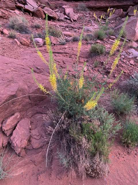
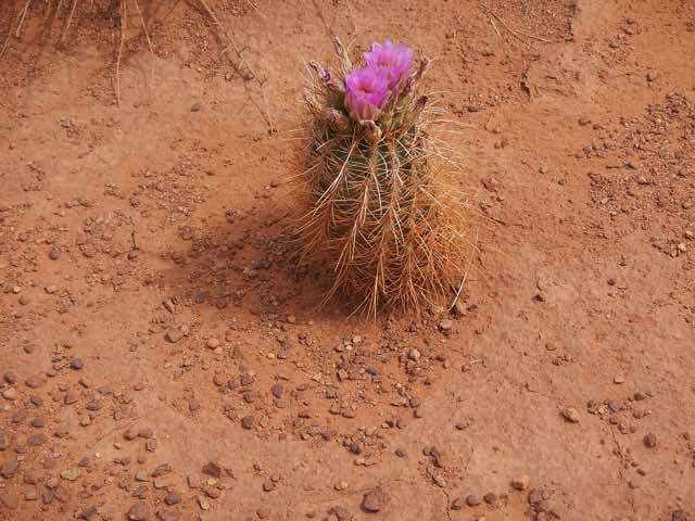
These flowers were common in the areas of UT that we had been
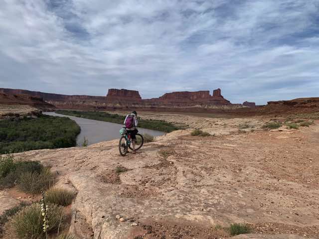
Slight view of Colorado River
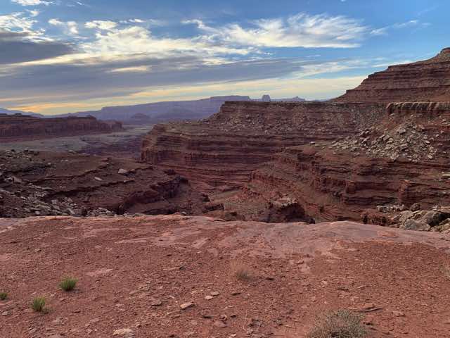
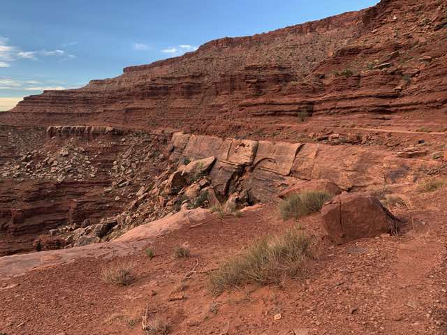
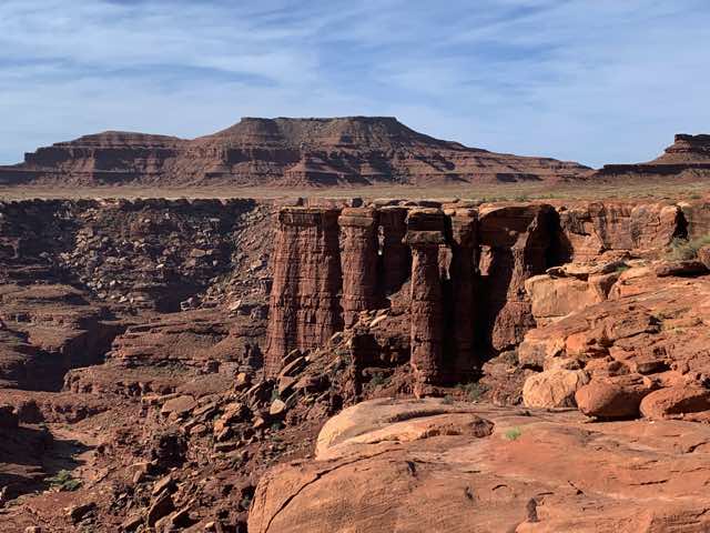
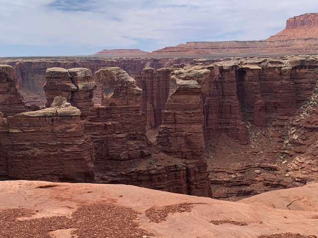
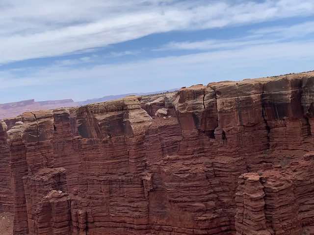
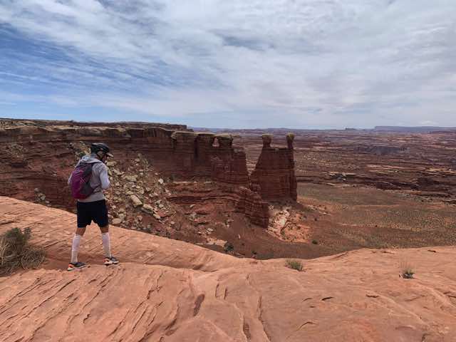
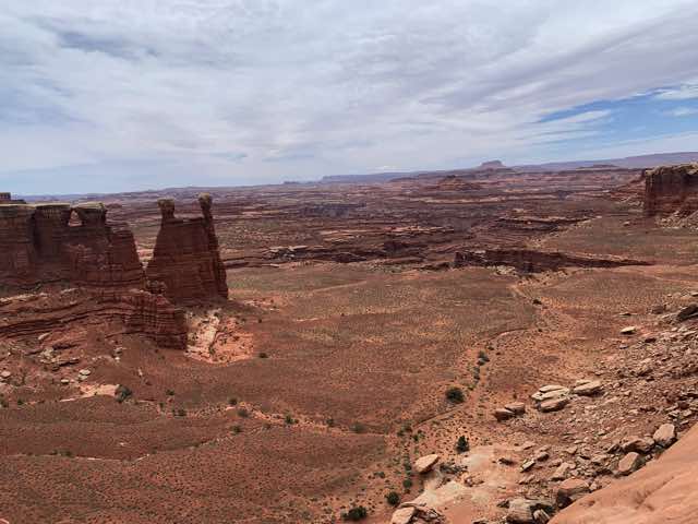
The scenery here was often amazing. Often there were various large protrusions or columns that came up out of some bedrock; I think the right name may be a hoodoo. (If they are larger on top, sometimes these are called "mushrooms".) We also saw various arches, which are just rock formations that have a "hole" of some sort (or as a mathematician may say, a genus 1 surface). There were also various interesting flowers and plants. As in other places, we often saw geckos and occasionally saw pinyon mice. In various places we saw coyote tracks and the next day by the river we saw lots of deer and many other tracks.
Interesting rock formations, several of which might be classified as mushrooms, if I understand it correctly. (7:30)
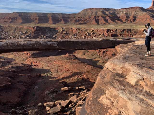
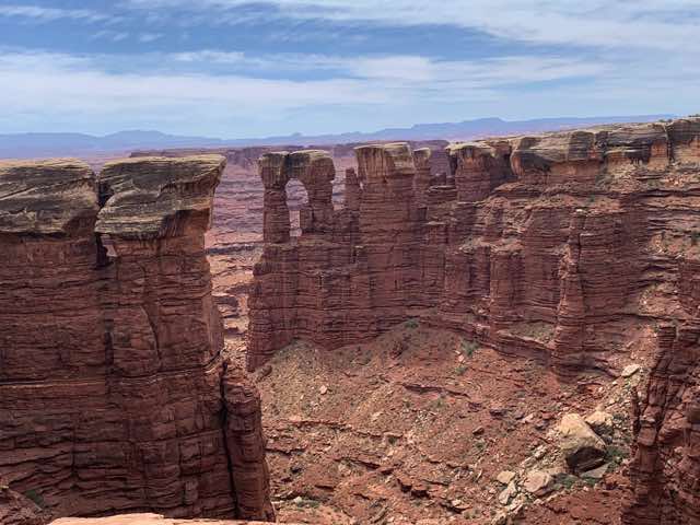
An arch with a huge distance to the ground below. Norm said some bikers challenged each other to bike across this. Fools.
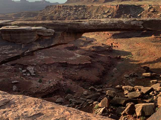
The other end of the arch
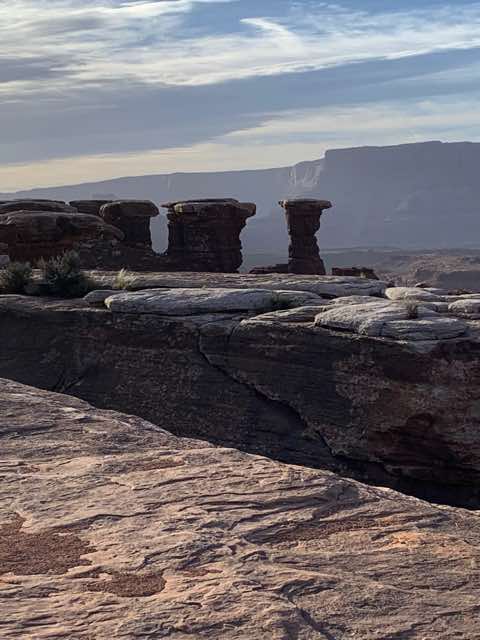
More interesting columns (8:30)
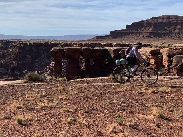
Norm riding right past these "mushrooms"
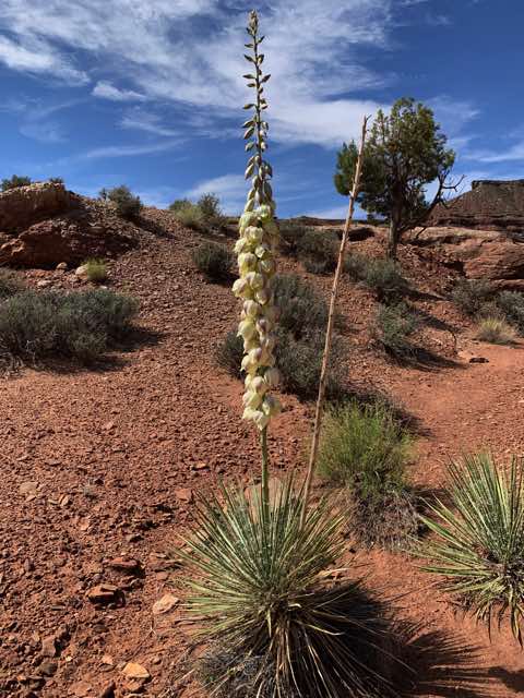
A flowering yucca plant with the top flowers yet to appear. This had more flowers than any other I had seen before or afterwards. (10:13)
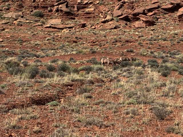
Another treat that came our way a bit before 10:30 this day was a herd of 9 desert bighorn sheep. They were grazing in an area where galetta grasses and blackbrush were the dominant plants. We were just biking along and I saw them off to the right. We were in a lower area, so they couldn't see much of us, but even as we moved up they largely stayed in the general area after moving 100 yards further from us. We watched them for 5 minutes and it was great.
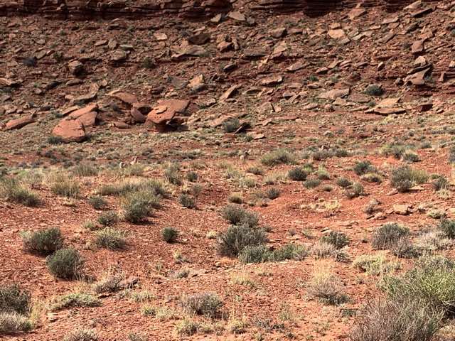
Three bighorn sheep are visible. Can you see them?
Closeup of some bighorn sheep
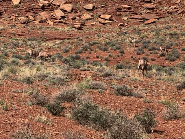
Eight bighorn sheep are shown here
We continued on and from noon to 1:00 we saw some more great rock formations. One feature to the trail that became more apparent while biking that I didn't notice when looking at maps of the trail is how convoluted it is. On paper, the trail roughly follows an elliptical loop with zigs and zags in places. But in person, you realize that for each canyon that exists in your area, you have to bike around it. For example, if you zoom in on the map in the Bikepacking White Rim route near Airport Towers (about mile 18 if you follow the dot on the trail and the altitude chart below the map), here are the directions one goes: SW for .3 m, WNW for .3 m, NNW for another .3 m, W for 0.5 m, NW for .2 m, W .1 m, S for .6 m, E for .2 m, S for .1 m, W turning to NW for 1 m, S turning to SE for 1.4 m, SSW for .2 m, W for .2 m, then turn north for a bit, west a bit, then back south and ad infinitum. Since the wind varied blowing out of the SE to SW, we sometimes had headwinds, tail winds or anything in between. And there were often gusts of winds that had higher speeds and sometimes brought swirls of sand as well.
Can you see that we have to go around this canyon on the left?
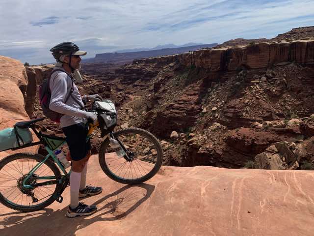
Big canyon below and bedrock under Norm right up to the edge
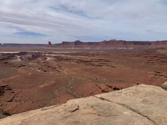
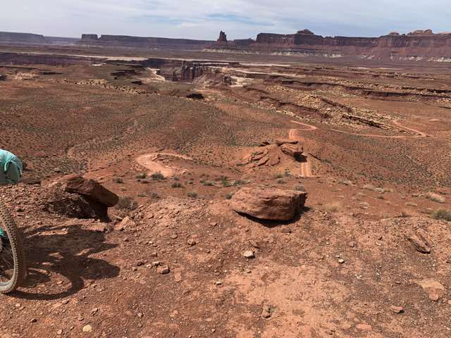
View an hour later (12:05)
Arches, spires, columns and mushrooms.
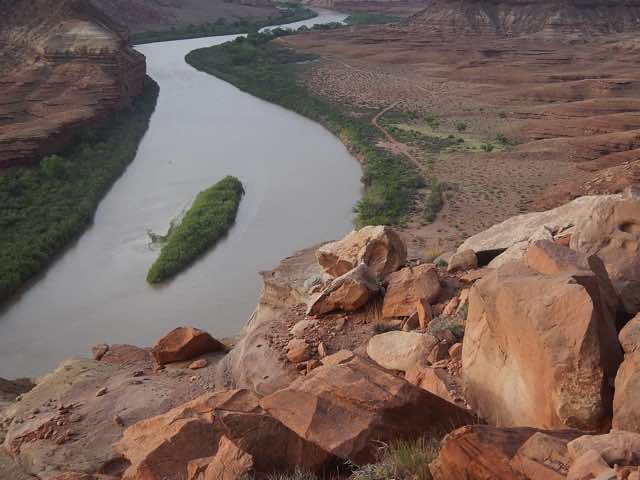
Large bedrock at the edge of a cliff down to the river
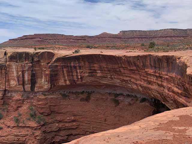
Large bedrock overhang
Similar shot by Norm
Canyon wall near us
Note the fallen rock in the background to Norm, as well as the mushrooms in the center.
Another view from rotating right with more evidence of fallen rock (which is pervasive throughout the whole region)
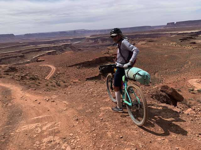
Taking a brief break
In the early afternoon, there was an hour or so where it felt like we were riding through a desert (which, of course, we were). It was flat with no rocks but mostly scrubby brush (blackbrush) and the trail/road had lots of sand. Sometimes the sand would be so much one needed to change tracks or just walk a little. In the middle of the afternoon, we got to the Murphy Hogback region of the White Rim Road. (Click here for an interesting video of a camper climbing this. Do you recognize the music? Actual video. Video shows the easier direction up.) That was something. Going up was very steep and there were many loose rocks. We both ended up pushing our bikes up portions of it. Going down was harrying as well because of the rocks but one could usually ride all the time. However, we had to worry about going too fast lest a sudden small rise of rocks causes issues.
Part of the "desert" region
Wide open area
Claretcup cactus were less common than the prickly pear and Norm found a nice illustration
I believe that this was part of the Murphy Hogback region. (3:00)
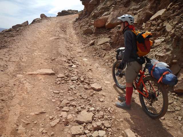
Walking up part of Murphy Hogback
Another view - would you want to confront a jeep coming around this inside corner?
Good view at the top (5250')
View of the descent from Murphy Hogback
The descent continues
And continues, with the trail laid out ahead of us
Another view from same vista
In the late afternoon there was a section less than a half-mile long and it was mostly just bedrock with various folds and rises. Three vehicles drove through at the same time as we rode and we could actually ride faster than they could drive because they tried to find two places for their wheels to go while we only needed one. It was interesting to see and hear their vehicles rock and slide back and forth across this road of solid, but uneven, bedrock.
Solid rock road
We soon passed Candlestick Campground and not much later Potato Bottom Campground also. Per our White Rim booklet, "Rumor has it that this area was originally named Tater Butt but complaints by humorless people led to the new vegetably-correct name." (Information about all campsites on the White Rim can be found here.) Both of these were places that we had decided we could stay at if we didn't think we could readily get to our site before dark, but our progress was sufficient to move on. Shortly, we reached the storm before the calm. That is, the HILL before the campground. Our designated (registered) campsite was Hardscrabble Bottom (legendary location of extremely challenging word-based games). Before this was the Hardscrabble hill, which was quite the challenge. We were already worn out and this was a quite steep in several sections. We rode what we could and hiked our bikes up the rest. Once we were at the top, we went downhill to the Green River floodplain and had easy riding.
Hardscrabble Hill was hard to scramble up
Looking down on the Green River and the trail that leads to our campsite. Yeah, we are going to make it
Our campsite was not very far at that point. It felt good going down the "driveway" to our campsite even though it was a half-mile that we would need to backtrack in the morning. We had arrived. Throughout the day, there were questions about how far we would get and could we make the destination's 64 miles that first day, but we just kept plugging away mile by mile and made it. I think our arrival was about 7:45. The campsite had some nice places to pitch our tents and it was close to the river and not too windy. I told Norm that I heard an unfamiliar sound coming from the front brakes. He suggested that maybe the disc had overheated. As we worked on unloading our bikes to set up camp, I worked on taking off my gloves. Doing so, I noticed that both of my hands were a bit swollen. At the time I wondered if hanging onto the same place on the handlebars of this bike was a factor (in contrast to the drop handlebars on a road bike offering multiple hand positions). I also wondered if all the braking that we needed to do going down hills was another factor since I was squeezing the brake levers at times. We set up our tents and had more to eat and drink. Fortunately, our water supply was fine. We actually had several places along the way where we were offered water to drink, and often it was cold. One time we were also offered to sit in the shade that their truck provided or a beer, but we declined with the goal of moving toward the goal of our own site. We went into our tents and appreciated the night sky and I was thankful to God for the progress and safety of the day.
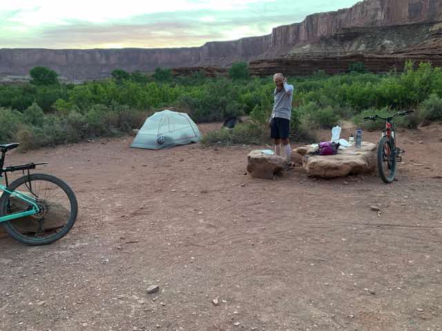
Campsite set up at Hardscrabble
Published 2022-05-23