Utah trip - day 9 - May 12, 2022 (R)
I must have been keeping up with getting enough fluids in the last few days (in contrast to day 2) since I heard the call of nature in the middle of the night. The wind was still strong and my Achilles tendons were still weak. I was glad to be able to get back to sleep, but I woke up sometime about 3 or 4 since the wind shifted from the SW to from the west, and it was stronger. Since my wide side was northwest, I could feel the wind trying to push over the tent. I just leaned into the side and eventually fell back to sleep. It continued to blow hard, but about 5:30 or 6 I got up and found Norm already up packing things into the truck. He recommended (I think) skipping the biking here and heading for Fruita, CO at this point, which was about 30 minutes away to the east. We broke camp, loaded things into the truck and got on I-70.
As we drove, I looked for a place to eat breakfast in Fruita. I found a place called "Starvin' Arvin's" that sounded interesting and the yelp review rating was decent. The link to the website only mentioned takeout, not eating in, so I called and found out that it was both. As we pulled in, there were many vehicles, which is usually a good sign. We fiddled around in the back of the truck for a bit before going in and as we headed there, someone yelled out the window of his running truck something about our MN plates. He was from there recently and welcomed us. We saw the menu posted by the entrance and both of our eyes fell on the item "Endless pancakes". We sat down and not much later we had our order in. Within five minutes, we each had a stack of 3 larger pancakes (a bit smaller than what I make, but not the little ones at some restaurants). I had tea while Norm had his usual coffee that he had missed the last several days. The pancakes were great and when done she asked us if we wanted more. We both responded affirmatively. I was surprised that she didn't ask how many, but she brought us both 3 more, which we both managed to put down, but with a little more effort than the first three. Since gas was bit more expensive there, Norm wanted to go on to Grand Junction to buy more gas.
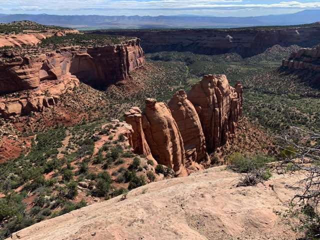
However, Norm had suggested an alternate route to Grand Junction: via the Colorado National Monument, part of the National Park Service. We went south on CO 340 which led us to the park entrance on the north side of the park. Norm's America the Beautiful forever pass got us both in. We started climbing up on the Rim Rock Drive that had lots of turns to get us up and then many more to keep us up there. We stopped at some pullovers where we could look out over the landscape. We then parked at the visitor center and began to hike the Canyon Rim Trail that took us behind the camping area. We were able to look down on canyons that had some similarities to the canyons in Canyonlands NP, but I think the junipers and other trees were a little bigger here. After getting to our destination lookout, we cut through the campground area back to the visitor center. We took a little break and visited their museum. There I learned that the previous name for the Colorado River, the Grand River, was because its origin is from Grand Lake (which is actually fed by a lake formed on the Poudre Pass in Rocky Mountain NP). We then left and made another stop at Independence Monument and another location further on. There was lots of beauty to behold. We then continued the scenic drive through the park and made our descent (via more switchbacks going down) in the SE corner of the park and then joined CO 340 again before entering Grand Junction. We bought gas there before getting back on I-70.
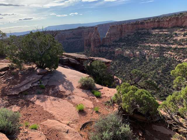
View from our hike
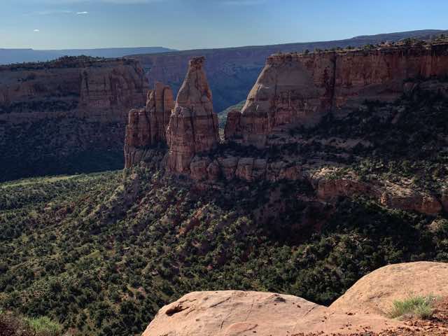
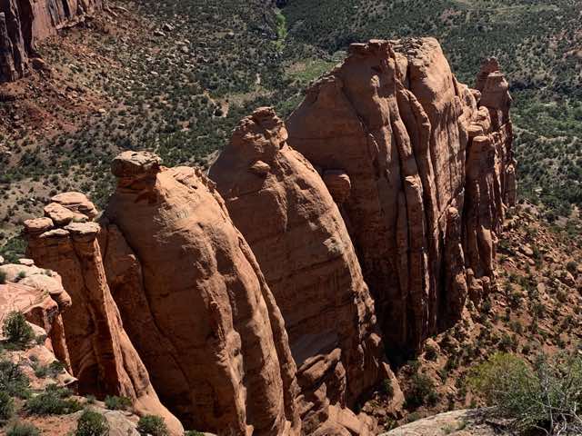
Close up of the area from the last shot
Independence Monument in the center; next image has some details
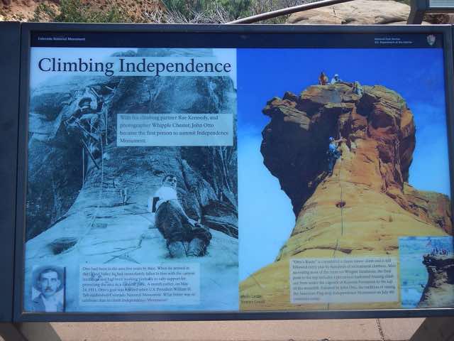
Information about Independence Monument
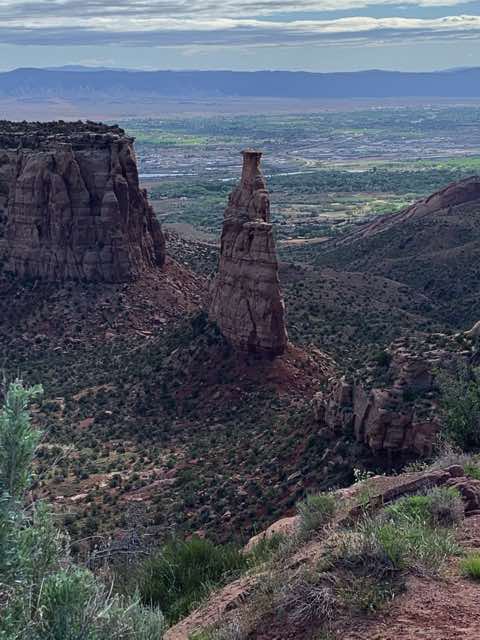
A view from another pullover
Close up of the last shot
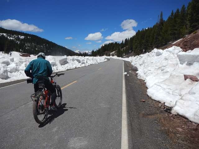
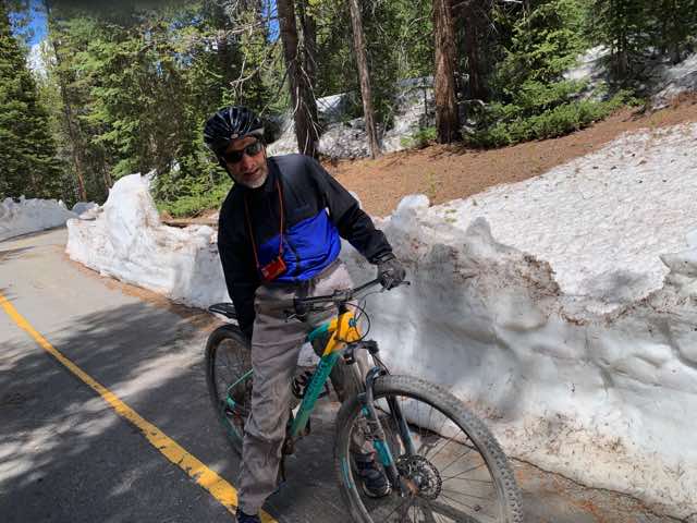
After checking the weather in Vail (if snow or cold, we would keep driving), Norm thought that Vail may be a good place to try find a bike trail. While Norm drove, I started looking. I found one that he had suggested (or I found - don't recall now) and I was looking into details for that trail. Upon further exploration in another app, I found out that the trail was closed until early June since now it was rut time for elk. So we looked for plan B and I came up with a trail shortly after Vail and the pass near there, which somewhat paralleled I-70. From what I could tell from the maps and description, the best place to access it was at the bottom of the trail (N-S, not elevation-wise), which meant to get off at exit 190 and park in the rest area. As we left Vail, we could see portions of the trail of interest and it looked nice, but some parts were being worked on by construction crews, so I wasn't sure how that would work out. After exiting I-70, when we saw that the road to the rest area and other roads were blocked and closed, we turned onto the short frontage road and parked. If we had been able to get to the rest area, we might have a different story to tell; more on that later. We had seen the trail for a while, and thankfully it had been plowed and was (mostly) free of snow. We got out our bikes and got dressed more warmly since the temperature then was 39. We headed down the frontage road and in a short ways there was a gate to get onto the bike trail. Following Norm's lead, we slid our bikes under the gate and continued. The plowed snow left banks along the trail from 2 to 6 feet high and, particularly when there was woods around us, it was quite beautiful. After about 4 miles, we could see a construction crew actively working on the trail and we slowed down. One vehicle tried to move to give us room, but we decided that it was perhaps time to turn around. Coming back was a little more work since more of the distance in this direction was uphill.
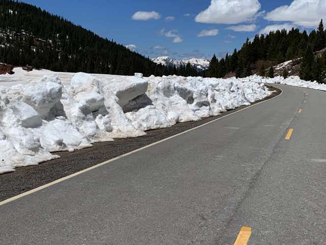
The frontage road to the trail
Not sure why I stopped here but I was glad I had all the clothing I was wearing
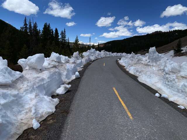
The actual trail
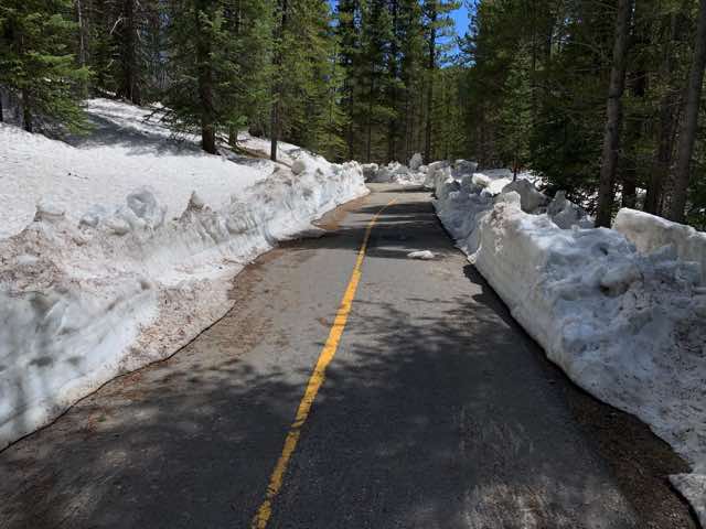
The trail through the woods was beautiful
On our way back, reluctantly
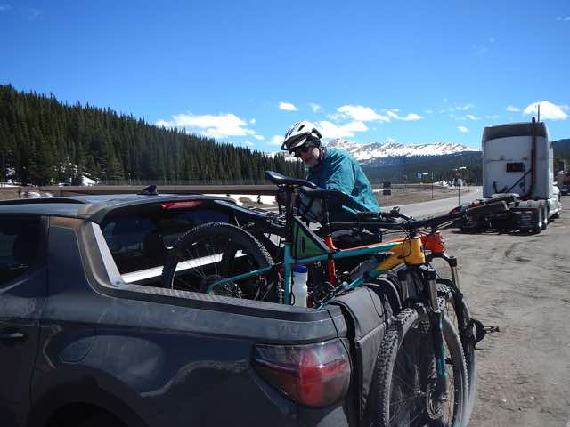
Securing the bikes again for the final ride (2:30)
Now for the other half of the story, boring perhaps, but the information may be useful later. As I wrote this 10 days later, I learned that the trail we were going to take was called "Vail Pass to Vail Bike Path" in the Mountain Bike Project app, which is what I used to find this while driving. (However, the map in the app has it labeled as Ten Mile Canyon National Recreation Trail.) The app didn't say anything about it being closed for construction, so that was a surprise and as we drove down I-70, it only seemed like there were a few short sections under construction, with most of the rest visible (in places) from the freeway as it goes on the east-bound side of the freeway where we started and eventually goes underneath the freeway and is on the west-bound side of I-70 up to Gore Greek Campground area, which does not have an exit off I-70 for access but one needs to go further west in town. This trail is 8.9 miles one way. However, what I didn't notice (or dismissed since it was 4.4 miles long) while we were driving was that there was a second ride in the MTB app that was listed with Vail with almost the same name: "Vail Pass to Copper Bike Path". This one starts at the (closed) rest area near to which we parked and goes downhill to Copper Mountain. But, it seems to also continue on to Frisco but this app didn't show this, which would have made it an 11.6 ride. At any rate, we got 8.5 miles of riding with some elevation to boot, and it was a good break. I find it hard to look at a little screen and try to expand to see details as well as the context. I had brought my iPad along for this purpose and I should have switched over to it, but I didn't.
After this, we continued on I-70, leaving about 2:30 or so. While there was a little bit of traffic in Denver, it was mostly for a short section and tolerable (says the passenger at the time). Norm kept driving until we stopped in Ogallala, NE where we filled up for gas at FatDogs for the truck and for us, Wendy's. Hey, Norm! If this was supper, where was lunch? I suppose it was the second plate of the endless pancakes. I then drove for a ways and then some time before Lincoln I needed to pull over for a break. Norm took over and drove until... Days get blurry about this time of the day. Continued in Friday's entry.
Published 2022-05-23