home » stories » tripssearch within stories
May 2024 Trip to England
This will describe my trip to England in 2024. I left home on May 8, arrived in London and took a bus to Leeds on the 9th, met Lou and Jan on the 10th, hiked the Herriot Way May 11-14, then hiked and birded from May 15- (starting on the coast east of Leeds, going north, then west, then south back to Leeds)
2024-05-08 - Wednesday
I left for Des Moines about 7 and arrived at the Keck's parking lot before 8. There was essentially no one in the security line, so that went fast. I worked on some things and was soon on my 10:40 flight to MSP (Mpls). There were some issues with our flight to London Heathrow, finally leaving at 6:30 instead of 5:10. I arrived the next day (Thursday), and then it took the whole day using a bus to get to Leeds, since the trains were on strike. I met Lou and Jan at noon on Saturday, and we headed toward our destination, Garsdale.
2024-05-09 - Thursday
The plane landed at 8:15 instead of the scheduled 7:15. I was going to take a Megabus to Leeds since the trains happened to be on strike for the day. It was supposed to leave at 12:30, but it was at least an hour late. That was the name of the day: late. Almost every step of the way. I didn't get to Leeds until 9:45 at night.
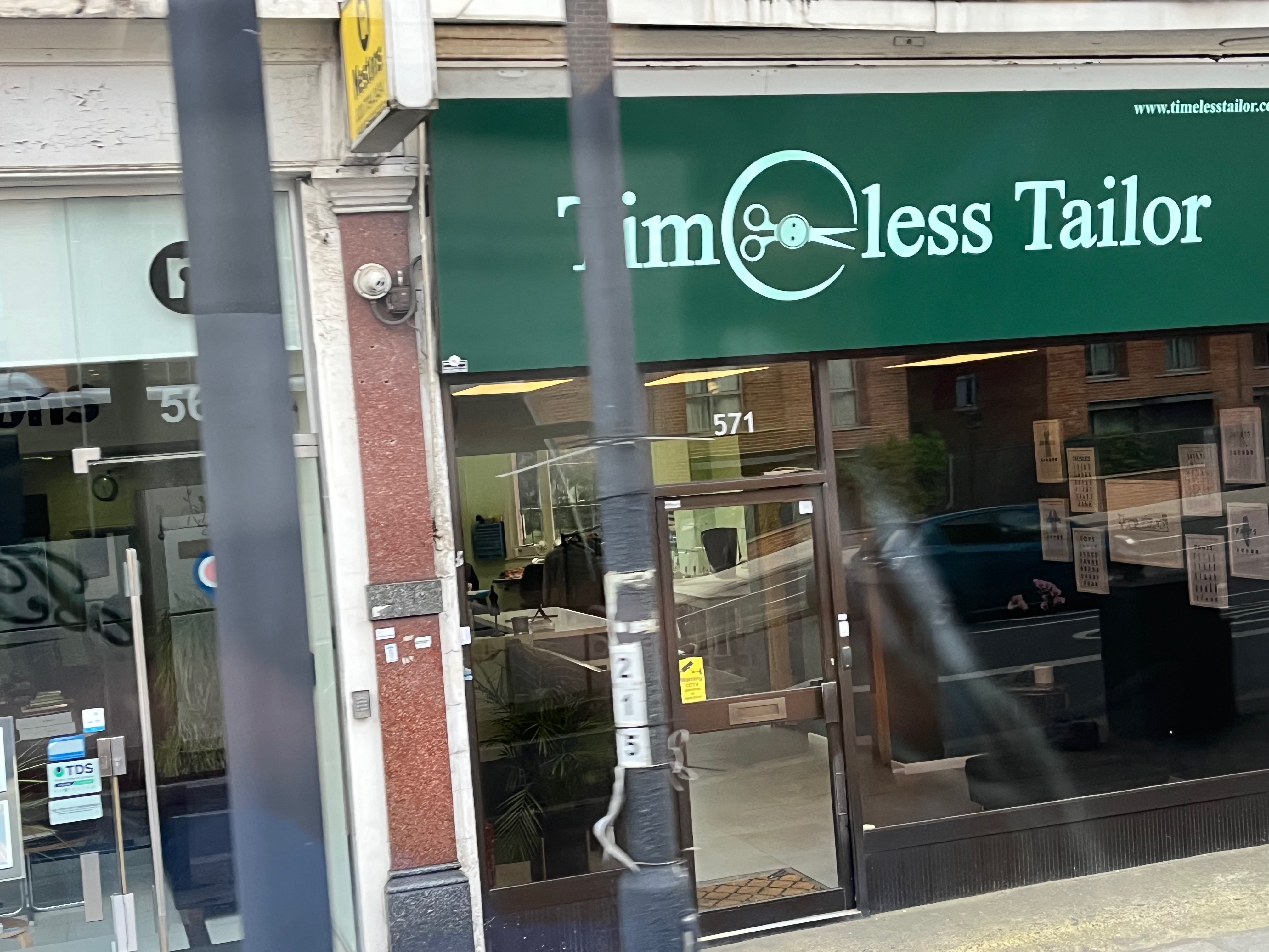
This was a photo I took as we took our time leaving London. I liked the sign for the business.
2024-05-10 - Friday
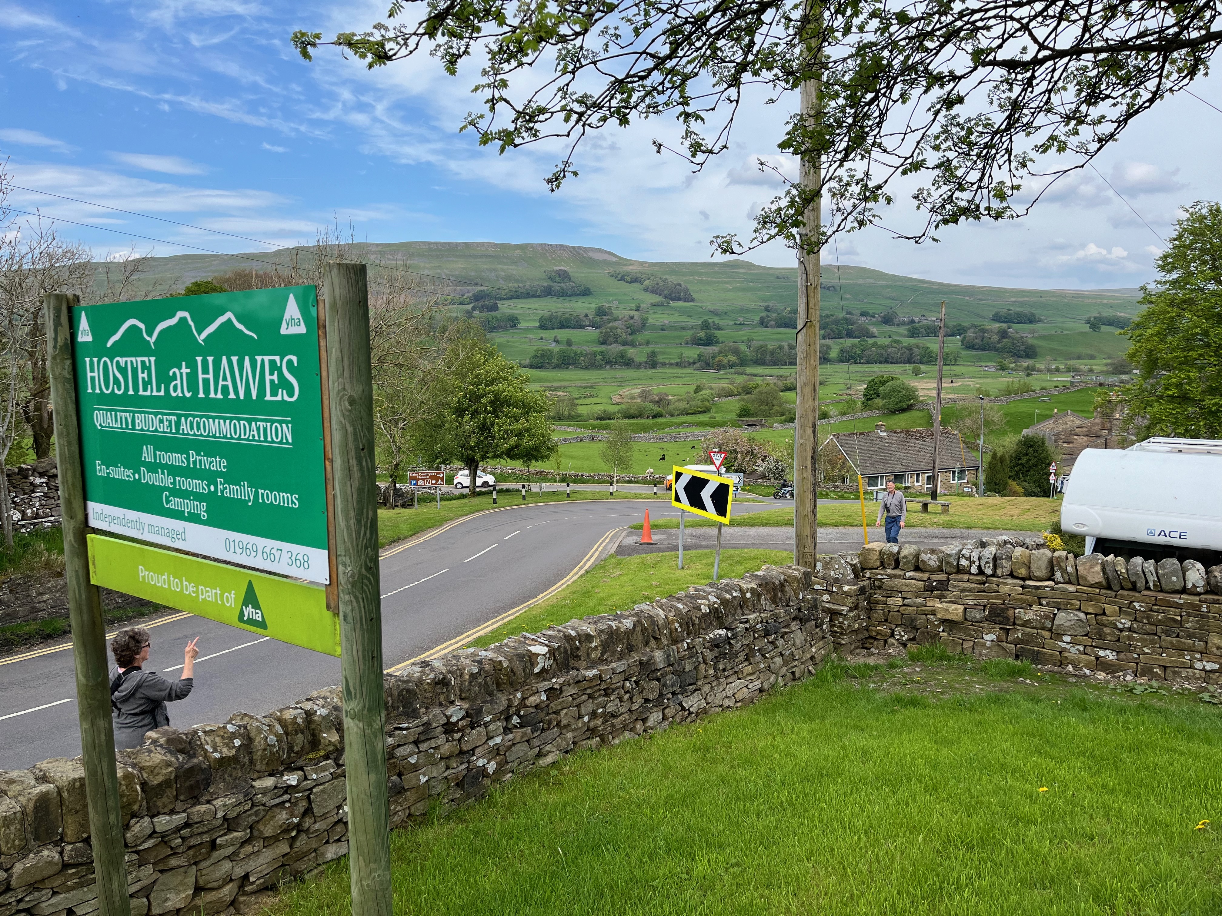
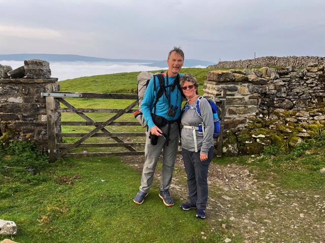
I slept well and had breakfast at the hotel. I met Lou and Jan about noon as they came up from London on the train. We left an hour later for the Garsdale station. From there, we took the little White Bus to take us to the town of Hawes. We checked into our youth hostel, ate an early supper at Wensleydale Pantry, and then did some organizing at the hostel. We then did some birding in the evening.
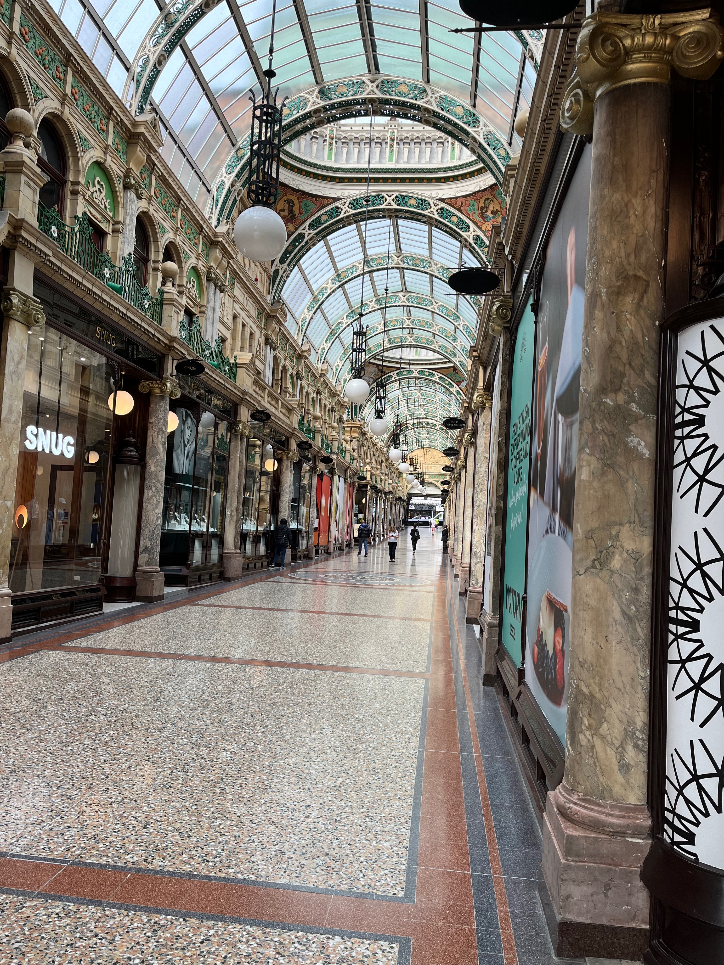
As I walked to the train station, I found this interesting outdoor downtown section that had an overhead canopy that made it feel quite pleasant and pretty.

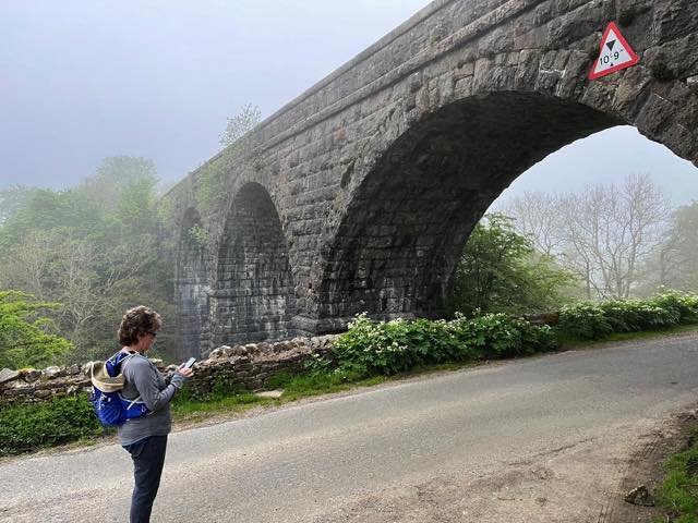
This is the train viaduct near Garsdale that we saw from our train.
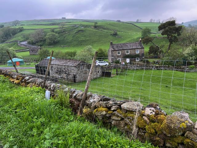
Looking north from our hostel at the edge of Hawes, we see hills that we will climb in a day. Jan and Lou are in the middle of the photo, talking to each other. It was (and is) designated as a market town. A pleasant place. We were all trying to get a lay of the land as we waited to check in.
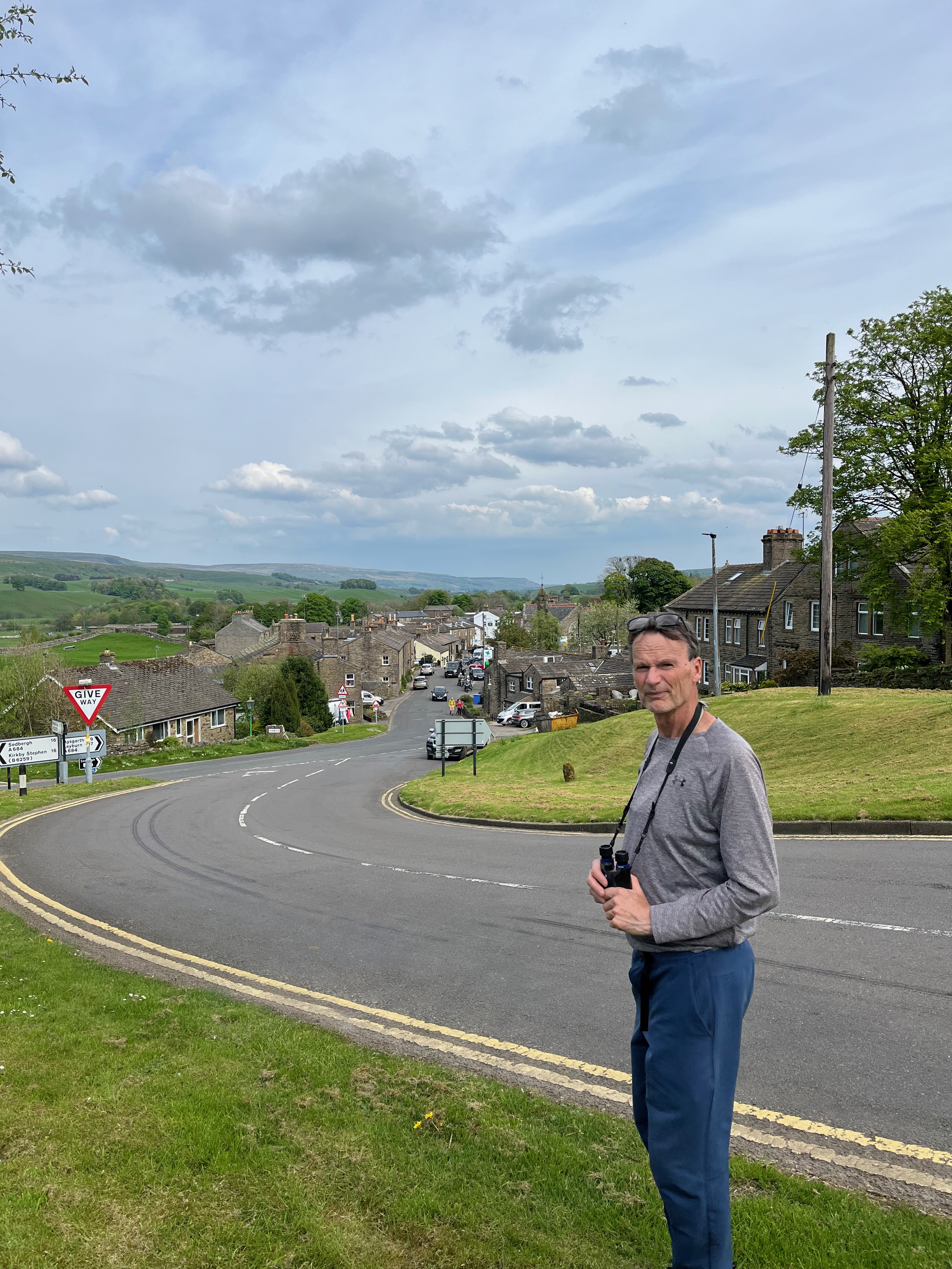
Lou is birding at the edge of Hawes. Most of the town can be seen in the next 3/4 mile along this road. Quaint town.
We are looking at the town of Hawes with several fields at the edge of town. Note that walls that divide the fields. They are all over.
2024-05-11 - Saturday
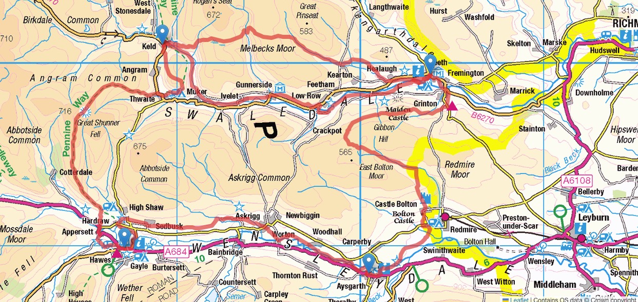
This gives a map of the area where we hiked The Herriot Way. We took a train from Leeds to Garsdale and then a bus to Hawes, where we had a hostel reserved for nights 0, 1, and 4. Hawes is in the lower left of this map. Following the orange path and blue markers on the map, on day 1, we took a bus from Hawes to Aysgarth and started walking west from there to Hawes. Day 2, we started north on the Pennine Way, going to Thwaite, and spent the night in Keld. Day 3, there was an upper and lower path, the former being the more challenging. We took that and ended up at Reeth. The last day was scheduled to rain all day (and it did), so we decided to skip the hike, though Castle Bolton would have been nice to view. There was no bus to Aysgarth, so we took an Uber to Leyburn and then a bus from there to Aysgarth and another one to Hawes.
From https://www.herriotway.com/route/ page: The walk begins in Aysgarth, home to the world-famous waterfalls, and heads immediately north to find the River Ure, which it follows closely through wide meadows and along a disused railway track into the lovely village of Askrigg. Here we find TV's version of Skeldale House, as well as a shop, tea room and pub. Beyond Askrigg the path climbs gently above the river through lush green fields, down narrow, secluded lanes and eventually into the tiny settlement of Hardraw with its famous waterfall and another tea room and pub. A final wander through the fields and the path arrives in Hawes, the highest market town in Yorkshire. The town has plenty of accommodation, shops, cafes and pubs -- everything a weary walker may need!
Distance: Approx 12 mls / 19 km
Height Gain: Approx 900 ft / 274 m
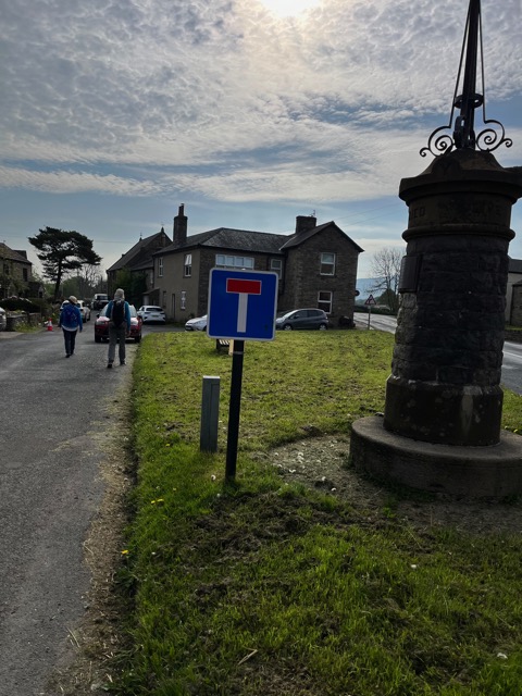
From Hawes, we took a bus to the starting line, Aysgarth, and walked back to Hawes for the night. On the right is a war memorial. This is a small village. Lou and Jan are ahead. We turned left at the large building on the right and walked through a narrow way (no signs) until we...
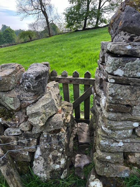
...shortly found ourselves at gate number 1 of 137. (Ok, only a guess, but a good one.) You squeeze through, push open the gate, and make sure it is latched when you leave. There were other devices to get us through or across a wall.
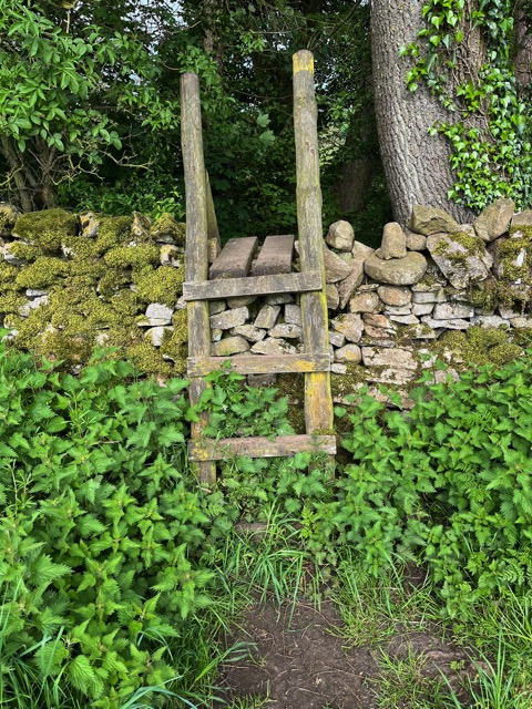
The basic choices are ladders to get you up and over, or gaps with gates to get you through.
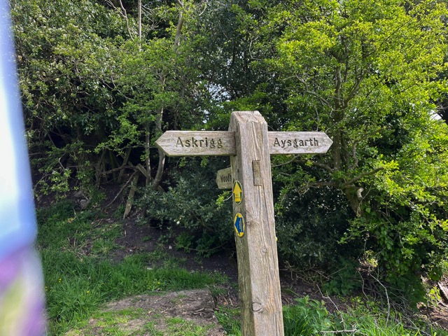
Occasionally, there would be signs to know where you were and where you are going. Here, we know we are on the correct path since we started in Aysgarth, and Askrigg is our next destination. Askrigg is the name of a village that some of you may know as Darrowby, the fictional village used in All Creatures Great and Small (first version).
Here is an example of a narrow slot that sometimes one needed to turn sideways to get through. I am holding the gate while shooting. Note the spring on the gate. Sometimes there was a fastener of one of the wide varieties.
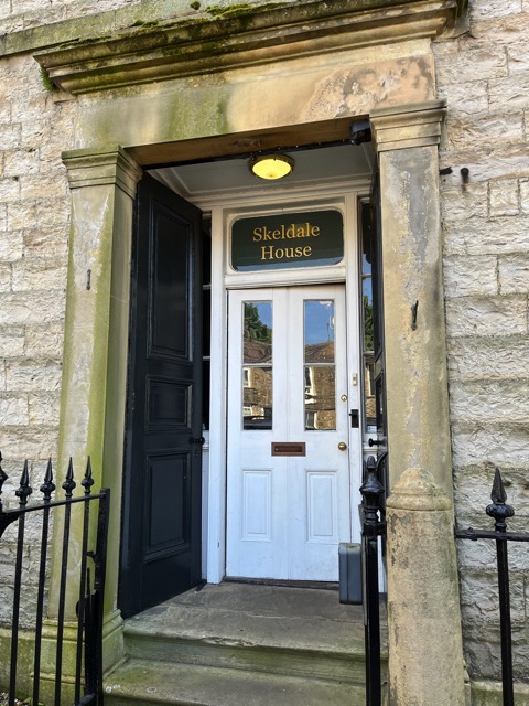
This was taken in Askrigg, and this is the Skeldale house. If you have watched All Creatures Great and Small, you may be aware that Skeldale House is where the vets' home and business were located. This house was used in the first version of the TV series, but now they are filming in another village. This location is now a rental unit, like an airbnb.
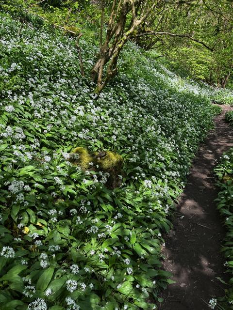
Sometimes we were in fields and sometimes in woods. This is a pretty section before we arrived at our next stop.
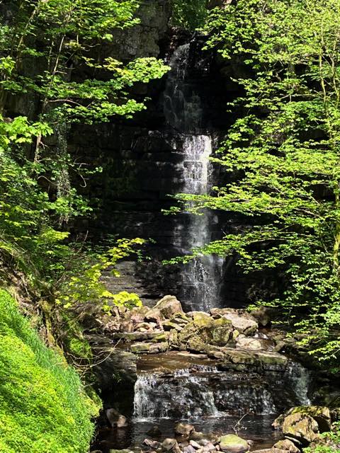
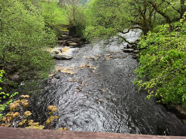
This is Mill Gill outside of Askrigg. A gill is a term to describe a stream in Britain. The waterfall was pretty.
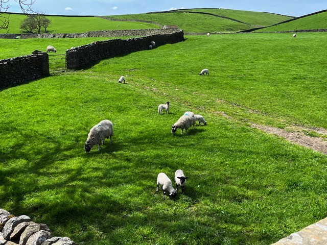
You can see lots of stone walls here and many sheep as well. The gate on the left is big enough for a tractor. This is a typical view in rural Yorkshire.
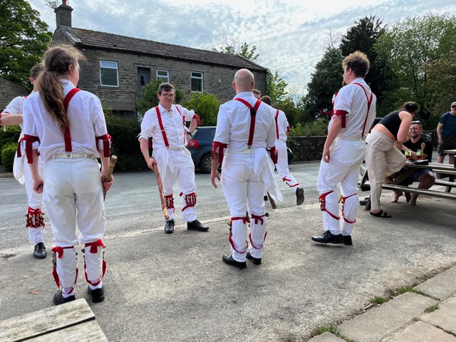
Our Herriot Way took us through this former village of Hardraw (now just a Cable, if you know that place). We had plans to take a look at the nearby waterfalls called Hardraw Force (i.e., waterfall -- 100 ft drop), where Kevin Costner was filmed for the movie Robin Hood: Prince of Thieves. However, we saw some activity and checked it out. The day before, when the Little White Bus transferred us from the train station to Hawes, it first made a stop to drop off a worker at a Green Dragon Pub/Inn here in Hardraw. When we came to that pub, we saw these troup getting ready to dance and play (musical instruments). They were actually not bad. They were trying to replicate old-style music and reenact dances from 2 to 3 centuries ago. It was quite interesting. I have a video, if anyone is curious.
2024-05-12 - Sunday
From https://www.herriotway.com/route/ page: Yesterday was mostly flat and eased walkers gently into the Herriot Way. Today is likely to be more challenging with a couple of big climbs, but the path mostly follows the Pennine Way today, so navigation should be fairly simple. The path leaves Hawes and uses field paths to reach the lower slopes of Great Shunner Fell-- Yorkshire's third-highest mountain. A good track takes the path upwards and an obvious paved path leads all the way to the summit shelter and views across the whole of Yorkshire, and beyond. A long steady descent, still on obvious paths bring the Way into Thwaite where a tea room and a pub offer refreshments before heading up and around the slopes of Kisdon Hill into the tiny hamlet of Keld, one of the most picturesque settlements in the Dales.
Distance: Approx 12½ mls / 20 km
Height Gain: Approx 2,800ft / 853 m
High Point: Gt Shunner Fell (2,349 ft / 716 m)
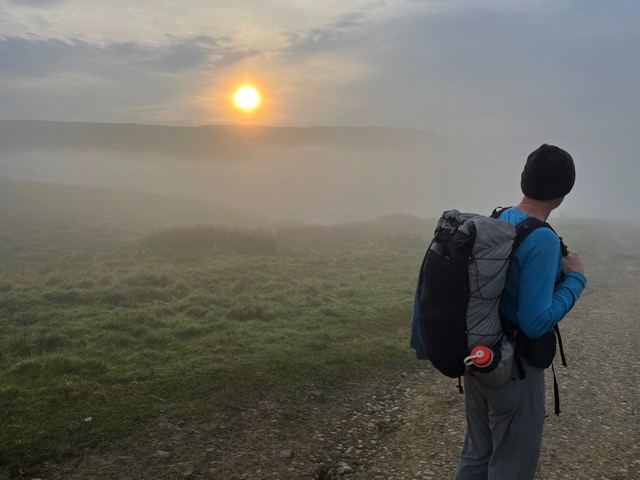
After an early breakfast, we started hiking at 5:10 on day 2. There was a potential for rain in the afternoon, so it made sense to have an early start. This was at 5:40 in the morning, and we had already walked a bit. This is another view of a train viaduct. It goes over the road and over the Widdle Beck (i.e., stream or river). It was quite foggy for several hours. Jan might be checking the Merlin app for a bird song, her email, or something else.
This was 40 minutes later, and we are heading toward Great Shunner Fell. What is before Lou, and us, is just an initial climb towards this 2350 ft peak. It is the third-highest peak in the Yorkshire Dales See the map below.
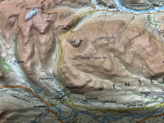
This is a relief map that was in the Inglewood home that we later rented. Hawes is just south (below) of Appersett (in the lower left). We mostly headed north until we got on the red dashed line (Pennine Way). Great Shunner Fell is in the upper left corner, 716m.
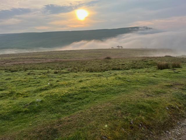
This was 20 minutes later, and the banks of fog hung in various places. We are looking at moors here. Also, our trail heads into the fog bank.
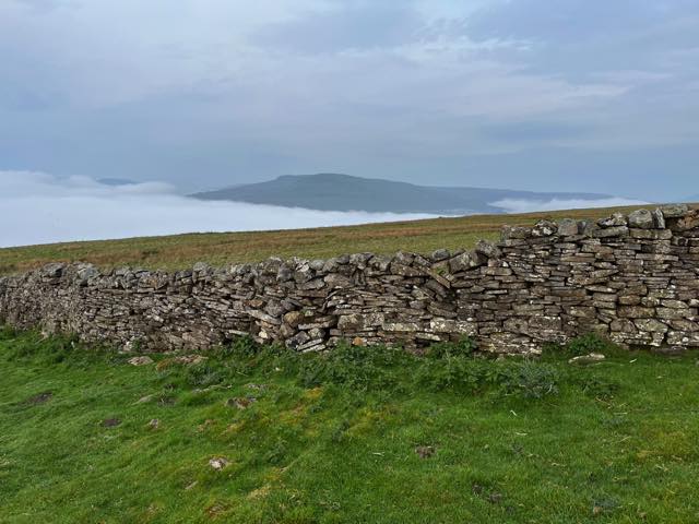
Even up here in the Morelands, walls are used to separate the fields. This wall looks like it could use some repair in the future. The fog bank on the left is the same one in the last image.
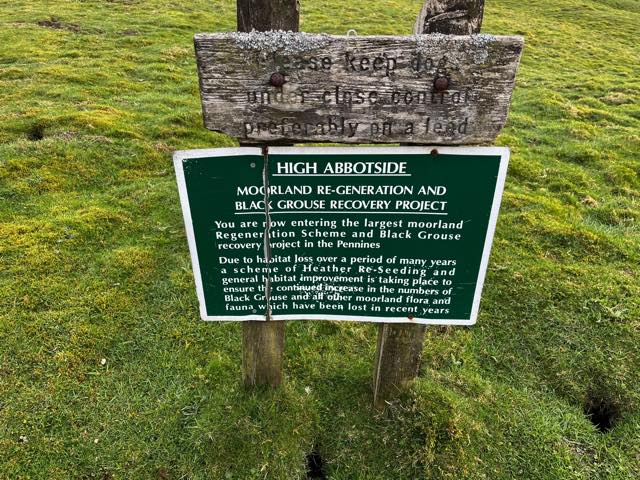
We saw this sign in the moorland where we walked. We looked and listened for Black Grouse, but I didn't record a site. I need to check with Lou about that. Notice the word "lead" for a dog where we use "leash".
As we hiked today, and on other days, we would find gates like this where large vehicles could get through the walls. For the next two days, we mostly had bigger gates like this one. There were at least 20 different latching mechanisms that we encountered. We looked forward to the next one to ascertain if it was a new style (not stile, if you were paying attention earlier) or not. I wished I had photographed more of them. Here, Lou and Jan oblige my request.
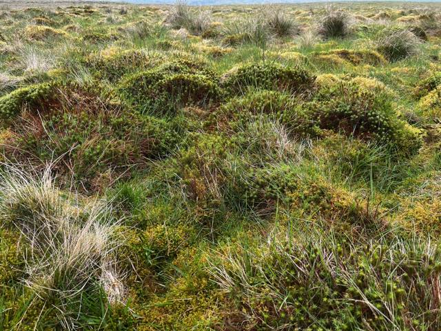
We saw mosses and grasses like this off and on. Good cover for birds and other animals.
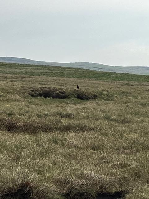
This was a grouse we saw, but I don't think it was a black grouse.
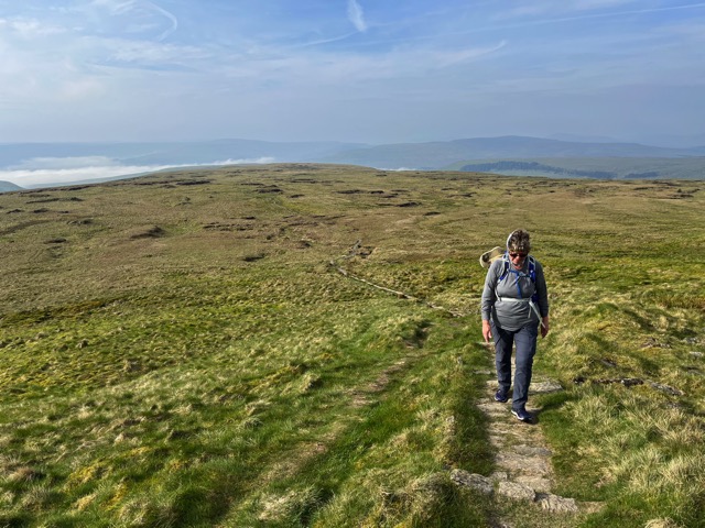
It is almost 8:30, and we are still climbing. This gives you a good view of how extensive these moorlands are. We are approaching Great Gunner Fell soon, and one can see for miles in all directions. The grass is not as lush as when we were lower. While it may look desolate, there were many interesting birds and vegetation to see here. Some places were boggy and moor-like.
We are coming to the top of Great Shunner Fell. As you can see, at the top are four 6-foot stone walls in the shape of an equal-sided cross (+) with benches in each quadrant. The shape was designed so that in at least one of these four quadrants, the hiker should find some reprieve from the wind at the top of this peak. And it was windy that day for us. We are still on the Pennine Way.
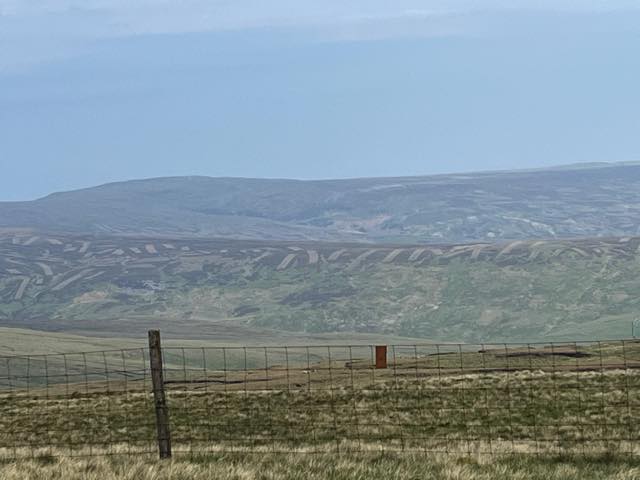
Near the top, we looked out and saw moorlands with an unusual pattern. Can you see these strange "stripes"? After seeing this in many locations, an inquiry revealed that a special mower was used to cut these. I believe (but will check) that it was to encourage new growth of plants that mostly comprised these sections, some kind of heather (I think).
Heading toward Great Shunner Fell, we were mostly going northward, but then [?? or earlier??] we got on the Pennine Way and headed eastward. Here, we are increasing our rate of descent, and the village of Thwaite awaits us in the valley to the upper left.
This shows a small gill (stream) that Lou and Jan are crossing on the flagstones across it. Note the walls on both sides since this is a recognized walking trail. Note also the relative conditions of them.
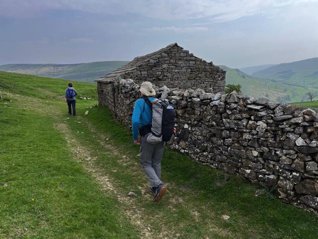
Note the building made of entirely of stone, including the roof.
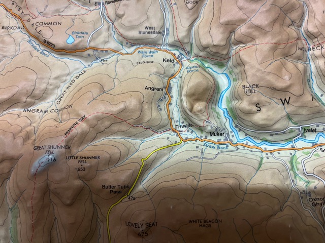
This map shows the second half of day 2 (from Great Shunner Fell to Twaite, Angram, then Keld). It also shows the first part of day 3: starting at Keld and heading east on the dashed red line, which is part of the Coast to Coast Walk.
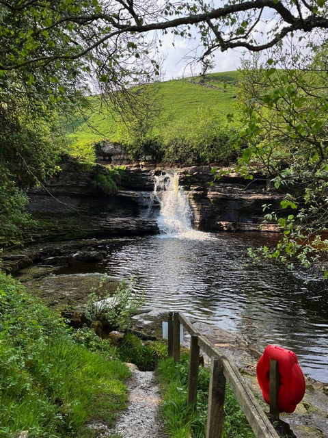
After we got to Thwaite, we had something to eat that we had brought. We then hiked back up a different hill to continue to the east towards Keld. We then descended from there and came to a road. However, we were not sure where to go, right or left. We tried left and then backed up. I then went right and found Keld and came back and got Lou and Jan. This is a view behind the area where we stayed. It was a pretty waterfall, and there were lots of birds around it. This is the Swale River, and there are 5 other waterfalls on this portion. Kayakers like to paddle here. It was not as calm the next morning after a very heavy rain during the night. The water was coming down in a region 4x as wide.
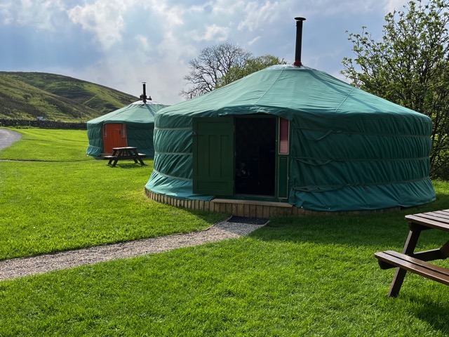
This is the yurt in which we stayed that night. We arrived about 1:30, just before the couple running the place were about to take off. It was really large with about a 25' diameter, fridge, water in an airpot, beds for 4, a table for 4 which we used for our supper, hot water bottles in "blankets", couch, and other things, including a nice skylight. We ordered our supper for later, showered, and got organized. We did some birding by the waterfall. We were told that the food would come at 6:45. Indeed -- WOW. We each had a glass square dish about 5-6 inches per side. Lou and I had ordered Shepherd's Pie (with lamb), and Jan a roast beef dish with biscuits. It was so much and so good (@£15) and we each had accolades for the dishes (as I later told Julia). I finished my dish, Lou did 80% of his, and Jan 65% of hers (though she gave a biscuit to each of us). When done, I took the tray back to them and paid for the meals and the Yurt. Later, it started raining, then pouring, then storming with close thunder. Very loud in the Yurt. A lot of heavy rain came, and we were glad that we were inside.
2024-05-13 - Monday
From https://www.herriotway.com/route/ page: After yesterday's exertions over Shunner the Herriot Way offers a choice of routes to reach Reeth. This traditional route climbs away from Keld using an old miner's track, up the glorious Swinner Gill and onto Melbecks Moor. A wide shooting track leads across the moor before the Way drops down through the heather to find the remains of the lead mining buildings at Blakethwaite and a perfect spot for lunch. After another short climb, the path soon begins to descend gently, past more ruined buildings from the lead mining days along Old Gang Beck and down to Surrender Bridge. From here the path returns to open pasture land, more gentle riverside paths beside the River Swale, and into Reeth, the heart of Swaledale.
Distance: Approx 11 mls / 18 km
Height Gain: Approx 2,000ft / 610 m
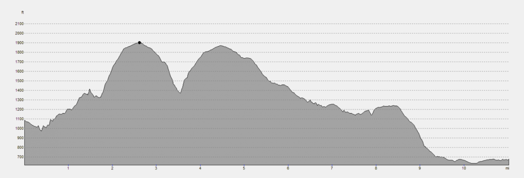
High Point: Melbecks Moor (1,898 ft / 579 m)
I took this photo the next morning as we left our great stay in a yurt. A nice view.
We are crossing over the River Swale. The water was moving fast after the hard rains the night before.
While the trail looks quite defined here, it gets less so later this day. In fact, several times we lost it completely. Here, we are climbing but still walking next to the River Swale.
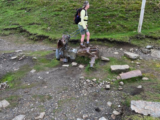
This was an interesting site along the path. This is likely part of a tractor from the past. What's next?
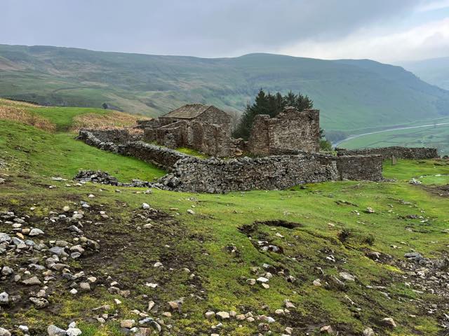
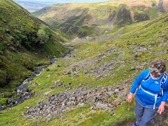
Here is the view as we moved a little further down the trail. This used to be the home of some farmer/miner from years ago. Note that you can see the River Swale in the upper right. We are going to keep climbing, but over the little hill just past this farm, there is the East Grain gill, which flows in the River Swale. We don't descend down, but stay up on the ridge and climb higher.
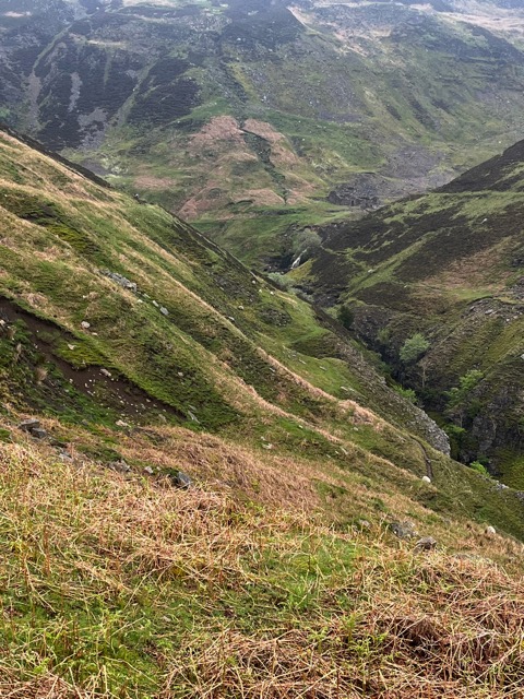
Ten minutes later, here is our view. After climbing, we are about to descend. And then ascend again. Note that in almost the exact middle, you can see a waterfall. We are heading towards this waterfall. It is pouring water from the upper East Grain, but you can see a valley to the left as well. That is the stream called Hind Hole Beck which joins the East Grain gill. Note that our route is called the Coast to Coast path.
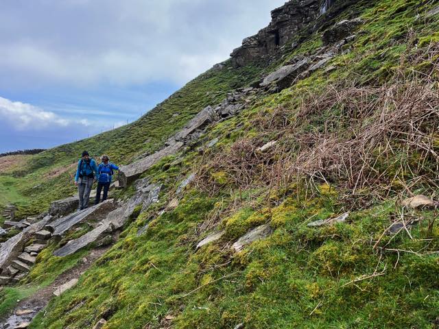
Our descent was steep at times, and the rock was sometimes slippery from the rain the night before. There were some sheep along with us in places.
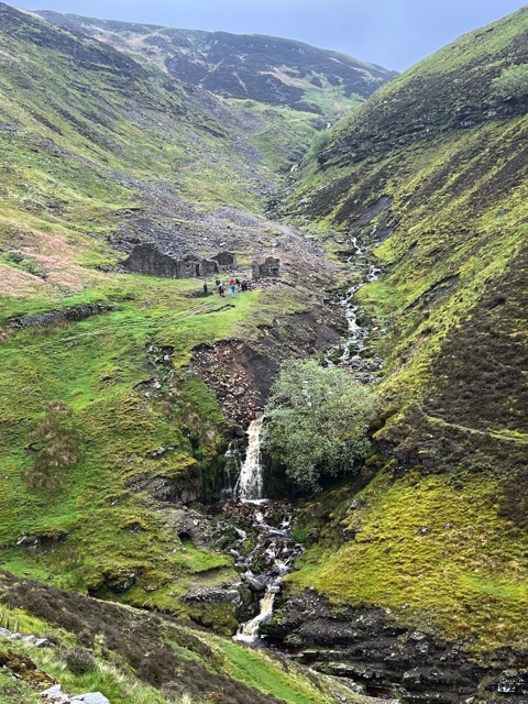
In this photo, we are about to arrive at the waterfalls. Next, we continue to climb up alongside this East Grain Gill. Note the people up by the remnants of an old lead mine in this photo.
Here, we look back at where the waterfall was. We continue on the red dashed line (on maps above or below) toward Gunnerside Gill, then Melbecks Moor. Gunnerside Gill (creek) is where Lou and I disagreed on where to proceed since his trail app had an error and I inadvertently missed an important comment on my guide.
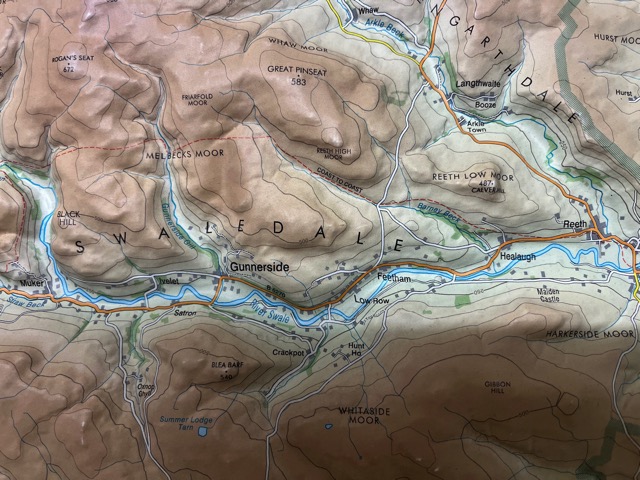
On the map, you can see the hamlet of Gunnerside near the River Swale into which Gunnerside Gill feeds. We crossed this gill a bit above where the words "Melbeck's Moor" are, but not on the red trail as the Herriot Way guided us to do. On this map, if you look above the words "Melbeck's Moor" (with the "B" on Gunnerside Gill), you will see "Friarfold Moor". Lou's app had suggested that we cross the gill above where the red dotted line comes to the gill. But there was no crossing there, only further downstream. So we wandered upstream for some time looking for a crossing, but to no avail. Finally, we came back to where the app said to cross, took off our shoes and socks, and put the shoes back on. We then crossed walking in the stream, with Jan between us. We then wandered in Friarfold Moor (though we didn't have this map for at least another week) and eventually found a trail that took us in what we thought was the right direction. We eventually got back on the Coast to Coast (though we couldn't see the red lines).
2024-05-14 - Tuesday

We had a warm spring, and the tulips got an early start, but several weeks later, there were still some good ones.
2024-05-15 - Wednesday
We had a warm spring, and the tulips got an early start, but several weeks later, there were still some good ones.
2024-05-16 - Thursday
We had a warm spring, and the tulips got an early start, but several weeks later, there were still some good ones.
2024-05-17 - Friday
We had a warm spring, and the tulips got an early start, but several weeks later, there were still some good ones.
2024-05-18 - Saturday
We had a warm spring, and the tulips got an early start, but several weeks later, there were still some good ones.
2024-05-19 - Sunday
We had a warm spring, and the tulips got an early start, but several weeks later, there were still some good ones.
2024-05-20 - Monday
We had a warm spring, and the tulips got an early start, but several weeks later, there were still some good ones.
2024-05-21 - Tuesday
We had a warm spring, and the tulips got an early start, but several weeks later, there were still some good ones.
2024-05-22 - Wednesday
We had a warm spring, and the tulips got an early start, but several weeks later, there were still some good ones.

On Remi's birthday, after she got her special breakfast, we went to the Como Zoo and spent time there. She really enjoyed seeing the various animals. We went to a nice burger place that Alex and Christina and we all ate well. After her nap, Remi got to try out a bubble gun, which enthralled her.
May

Christina's family joined some friends in Des Moines and then came to experience Tulip Time. While Remi liked the parade, some of the bands were a bit too noisy until she gradually got used to them. Here, she was able to see the items in the parade lined up quietly before they took off
Below are a few photos from the UK trip that Lou, Jan, and I took in mid-May. For more photos from this trip, go here.

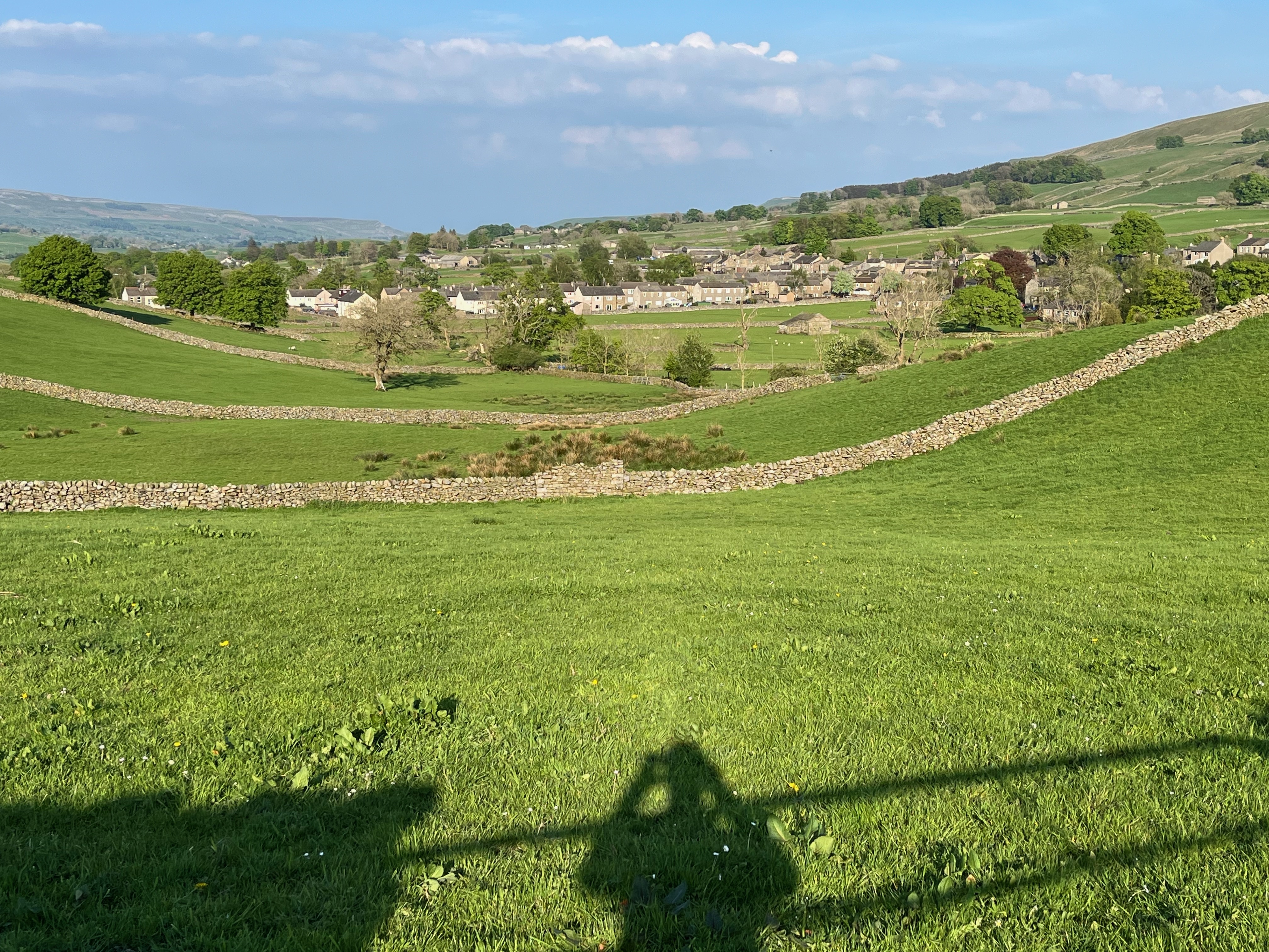
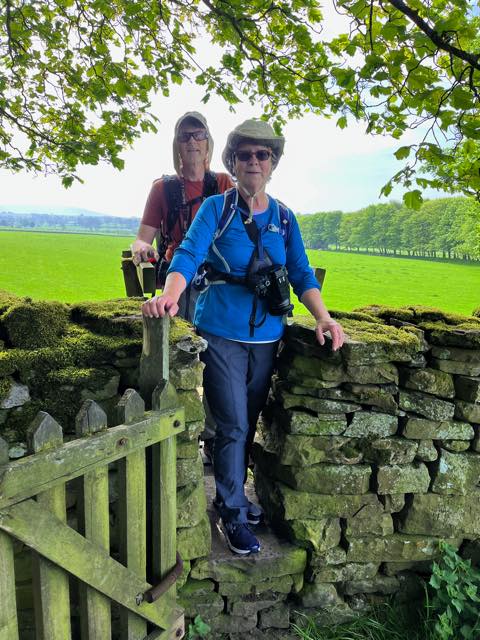
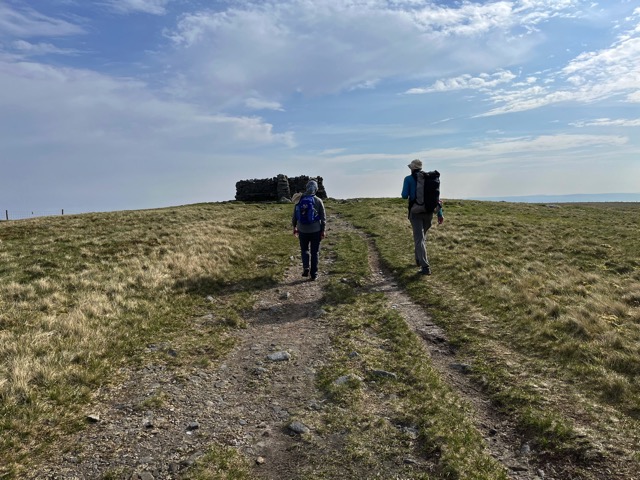
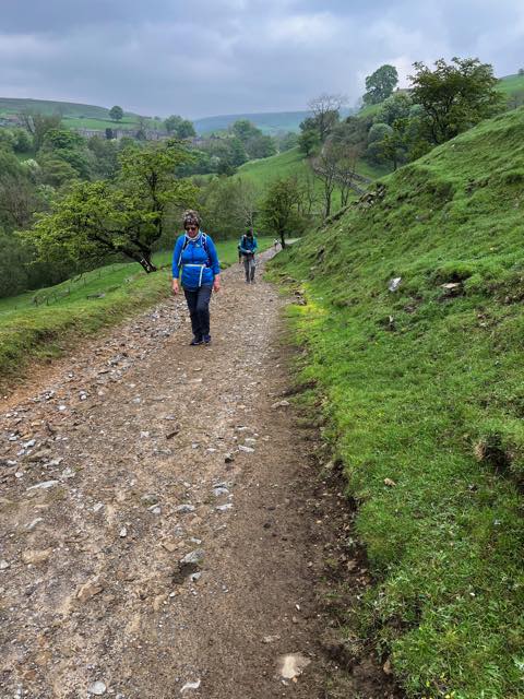
The first day of the Herriot Way hike was an easy 12 miles from Aysgarth to Hawes. Most of it was fairly level (gain of 900 ft), and we wandered through many fields with grazing sheep. Stone walls were used as fences for the sheep and other livestock, and the number of different ways of crossing the fences was amazing. Here, there is a stile with a gate, which was the most common approach. When the fields had flagstones, the protocol was to only walk there so as not disturb the grass that the sheep eat. But some sheep were hanging out on some stones, and we had to coax them off.

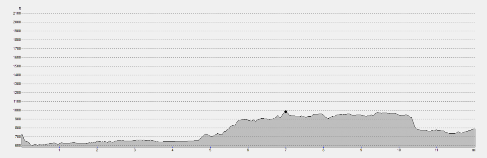
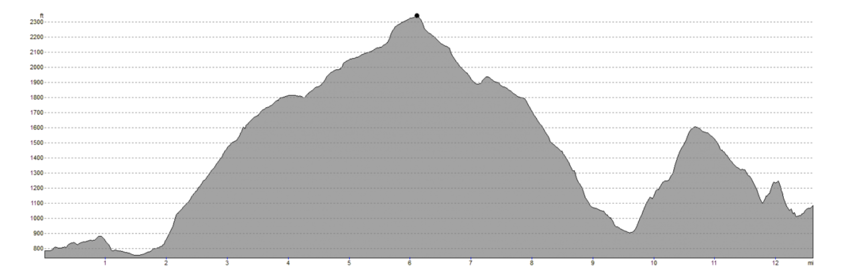
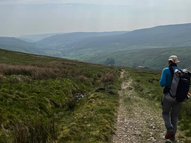
The second day of the hike was a not-as-easy 12.5 miles from Hawes to Keld. The total gain was 2800 ft, peaking at Great Shunner Fell, which we are approaching now on the left. The rocks you see are 4 walls, so that you can find at least one side that is the least windy. We were in meadows/moors and following the great Pennine Way. We saw no walkers until the end, and it was fairly desolate, but we had fun watching the birds. We left about 5:10 a.m. since there was potential for rain later. And it did come, but we were inside our yurt and ready for bed.

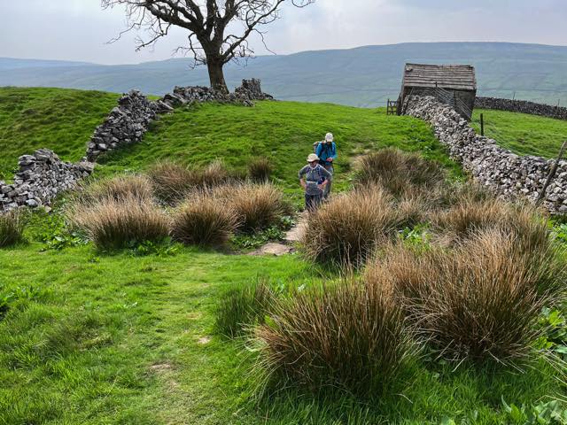
The third day of the hike was supposed to be only 11 miles from Keld to Reeth. The total gain was supposed to be 2000 ft, however, Lou was strictly following an AllTrails path that had a mistake (it had us cross a 10 ft stream with no bridge) and I was following a great book but at the important juncture, the details to search for were before the heading for the juncture. The bottom line is that we walked a lot further and waded across a fast stream, but we got there safe and sound. In the middle of the photo, you may see a little waterfall. We head down there and then climb back. Descend again, climb back out.

The day after our Herriot Way time, we took a train to Leeds, rented a car, and drove to Spurn Point along the eastern coast to do some birding. We saw a Sedge Warbler, Eurasian Magpie, European Goldfinch, Eurasian Linnet, Reed Bunting, and more. After spending the night in Scarborough (do you know the song about the fair?), we drove north to do more birding at Bempton Cliffs, where this photo of the puffins was taken. (Many thanks for Jan's telescopic lens on her camera.) We also saw: Kittiwakes, Gannets, Murors, Razorbacks, Guillemots, and more.

Two days after the last photo, we drove to a hostel at Hadrian's Wall and spent time there. The next day, Lou and I drove to the Lake District, parking at Glenridding (near the water on the far left central in the photo). We then proceeded to climb Helvellyn, the third-highest peak in England. (Look at an aerial view of the mountain in December in the last link.) It was a fun climb, but not for a beginner. There were several signs honoring people who had died there. This is a view looking ENE.
Short 1-minute video

The next day we drove to Ingleton and spent 2 nights there. Lou and I drove south to Malham and climbed Gordale Scar and hiked around Malham CoveMalham Cove and more. On top of the cove is where the photo on the left was taken. This is called a limestone pavement (with lots of cracks) and one of the Harry Potter films had a portion shot here. We actually saw lots of this feature in the area, but this was the best-looking portion.

I shot this photo while hiking in the Malham area. It represents a typical view in the Yorkshire region: walls of rocks making fences to give boundaries to farmers' fields. Note all the walls in the background. Often these are about my height. Also visible here, more distant background, is that there are often scattered rocks where a farmer hasn't yet cleared (or frost heave keeps providing more).

We rented a house in Ingleton for our last two days before heading home. On our last day here, we walked the Ingleton Waterfalls Trail. We started by walking on a trail that follows uphill along a river, and then we came back down along another river, and they both meet in the village. Along this trail, we saw many interesting waterfalls and birds (white-throated dipper, in particular). But then we came across this item on the left. Can you guess what you are seeing? Answer.
For more photos from this trip, go here.
June

On the first full day with Christina's family during my intermission of driving to the cabin, we took a hike at the Patrick Eagan Park in Eagan. Christina wanted to gather some nettle, and then Remi asked for a turn. If you wonder why she is wearing some plastic gloves, then you might want to read about nettle (which is also a good spinach substitute, if cooked).
July

Tim's family traveled to Florida in July and enjoyed a relaxing week at the beach. Ella, Adalyn, Ben, Landon, Chelsea, Tim.

In the third week of July, Carrie's family joined me at the cabin. David, Gabriel, Carrie, and Daniel, before we headed out.

Here, Gabriel (with Daniel holding on lest he slip in) and David are watching the fish and other activity. They had a lot of fun. We did a lot of swimming, canoeing, and paddle-boating.

Cousins Remi, Gabriel, and David played together at Christina's place while Carrie's family visited Christina's family after being at the cabin with me.
August

Losing a loved one is always hard. Christina, Alex, and Remi were each looking forward to sharing life with their daughter Suriya, but that didn't get to happen. One good thing that came out of this was Christina meeting someone at this burial who also experienced the same rare circumstances in her life, and they have become friends.

In early August, Ed and I kayaked on a portion of the Prairie River. We started where it goes under US 2, shortly before it joins the Mississippi. Our first hour or so heading upstream was dealing wth some rapids, and then it cleared up. We turned around shy of where it goes under CR 62. Here we are about to take the rapids back to the truck.

The boys were riding their bikes on their road and stopped for this photo to benchmark for their future growth.

First day of school for Ben, Adalyn, Ella, and Landon: 10th, 8th, 4th, and 6th grades, respectively.

The Mesabi Trail is a paved trail that runs from Grand Rapids (mostly) to Ely. This summer, Ed and biked from Grand Rapids to just shy of Hibbing in stages. We turned around here on this stage. I have ridden to Hibbing before and another day started in Hibbing and road about 20 miles east.
September

An early morning in early September at my cabin.

In mid-September, cousin Ed and I drove to the "Lost 40" (NW of Grand Rapids) and hiked and biked in the area. If you don't know about this place, check out the link since its background is quite interesting. We found a beautiful lake in the area, but our biking on the road was not so great since a road grader had just gone by. This was a BIG tree.

I usually stop at Christina's as I go up to the cabin or back, since it is halfway. Coming back this fall, I spent a few days playing with Remi (and Christina and Alex). Here, Remi is playing in her outdoor "kitchen", cooking me some soup.
October

Our local humane society needed families to foster shelter animals when Hurricane Helene's widespread damage to our region caused an extended power outage. We fell in love with our foster dog, Zoey, and she became an official member of our family in October.

Gabriel and David helping dad to make a chicken coop and pen.

Adalyn joined Cross Country this year after Ben was having fun. She had an incredible first season, earning the "Most Improved Over the Course of the Season" award from her coach and shaving ten minutes off her 5K time from her first race to her final race, nearly qualifying for the Varsity team.

In late October, I drove to my brother Bruce's MO home with the intention of biking the Katy Trail. I started about 7:30 and biked ESE for 40 miles and then returned, stopping for some hiking along the way. It was a pleasant day, and I had a good ride, some with a couple doing the whole ride across MO.
November

Ben joined Cross Country this year and was moved to the varsity team after his first race. He had an amazing first season (and was recognized by making it into the team's list of six Record Breakers and Makers), and his team finished 4th at the State Championship.

A family picture after David's performance at a local theater. The play was "Into the Woods"". David, Daniel, Gabriel, Carrie. Note that Carrie's jacket is a leather coat that I had bought for Marcia in the early 1980's.

Daniel, David, Carrie, and Gabriel at the neighbor's Thanksgiving display.
December

Christina, Alex, and Remi enjoy getting outside and taking a walk or hike.
If you want to see 11 more photos of the family, click here.
If you want to view more photos from my May trip to England, click here.